News Summary
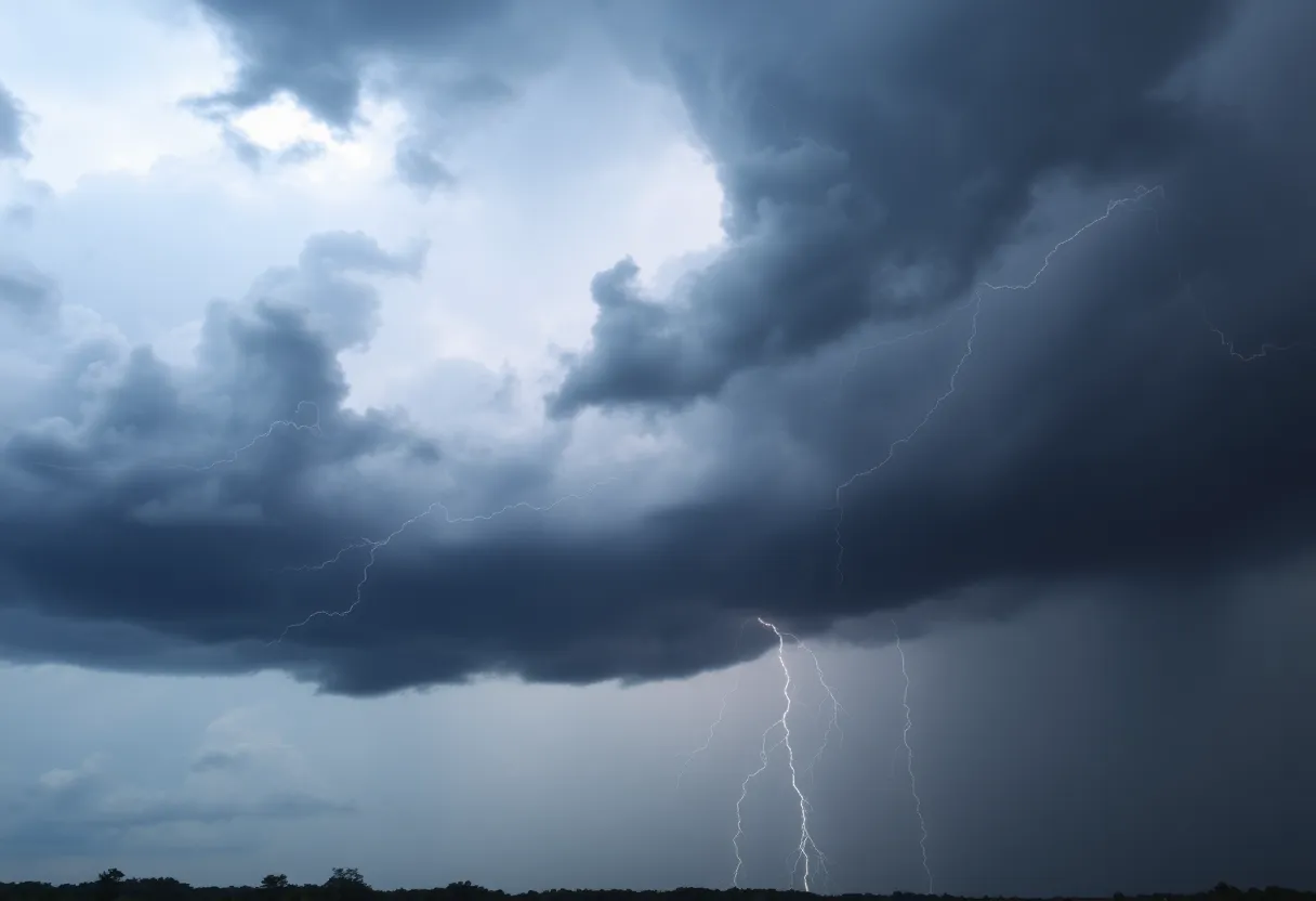
Residents in South Carolina, especially in Northwestern Orangeburg, Aiken, and Barnwell counties, should prepare for strong thunderstorms with wind gusts up to 50 mph until 11:45 a.m. today. The National Weather Service has warned that storms may impact several areas including Waynesboro and Bamberg. Additionally, slight risks for severe weather are expected over the weekend. Stay safe and seek shelter indoors during the storms.
Severe Weather Alert for South Carolina: Strong Thunderstorms Expected!
Attention, folks in South Carolina! A weather alert just came through that will grab your attention. So grab a seat and listen up – this morning, our friends at the National Weather Service in Columbia issued a severe weather alert for strong thunderstorms set to roll through until 11:45 a.m. Talk about a Monday surprise, right?
What’s the Scoop?
This alert isn’t just for one county – it’s affecting several areas, including Northwestern Orangeburg, Aiken, Barnwell, and Bamberg counties. If you’re hanging out in these places, you’ll want to be especially careful today!
As these thunderstorms develop, residents can brace themselves for some impressive wind gusts, reaching up to 50 mph. That’s not something to take lightly! Doppler radar has picked up a strong thunderstorm near Plant Vogtle that’s moving east at about 30 mph. Make sure you securely fasten anything that might take flight in these gusty conditions!
Where Will the Storm Hit?
If you’re in or around these spots, pay attention: Waynesboro, Barnwell, Bamberg, Denmark, Savannah River Site, Plant Vogtle, Williston, Blackville, New Ellenton, Jackson, Sardis, Alexander, the Burke County Airport, Gough, Barnwell State Park, Rivers Bridge State Park, Ehrhardt, Hilda, Snelling, and Olar might experience the worst of it.
And remember – if you find yourself outdoors during this thunderstorm, it’s best to seek shelter inside a building. Don’t take any chances standing around in this weather.
Keep an Eye Out for the Weekend!
And let’s not forget about Friday. There’s a Marginal Risk for strong to severe weather, including thunderstorms might be forming in the early afternoon. This means hot temperatures rising into the low 90s with dew points hovering in the low 70s – a recipe for storm development if we’ve ever heard one.
The Scoop on Possible Impacts
When these storms roar through, expect potential wind gusts exceeding 50 mph and hail that could reach down to the size of nickels. That could on occasion lead to power outages, knocking out electricity, internet, and phone services. So it’s a clever idea to have multiple ways to get weather updates before things heat up out there. Pack an emergency kit, just in case!
A Look at Thunderstorm Safety
Ever heard of hydroplaning? It’s something you definitely want to be aware of during a thunderstorm. Hydroplaning happens when there’s too much water in front of your tires, and it can lead to loss of control on the roads. Keep safe by heeding the weather warnings.
And just a little extra tidbit – the average annual lightning strikes in the U.S. amount to about 25 million, resulting in around 20 fatalities each year, mostly during the summer months. Isn’t that a shocking statistic?
Prepare and Stay Safe!
The weather might be a bit wild today in South Carolina, so stay vigilant! The storms are forecast to calm down by 11:45 a.m., and with a little luck, the rest of the day will be less stormy. Always remember to check in with reliable sources for the latest updates and, most importantly, stay safe!
Deeper Dive: News & Info About This Topic
HERE Resources
Severe Thunderstorms Hit Central and Southeastern South Carolina
Severe Weather Action in Texas as Emergency Resources Mobilized
Beach Adventures Await in Coastal Georgia
Preserving the Natural Beauty of Hilton Head Beaches
Severe Thunderstorm Alerts Hit Myrtle Beach and Nearby Areas
Severe Thunderstorms Cause Destruction in Georgia and South Carolina
Severe Thunderstorm Warnings in Upstate South Carolina
Severe Thunderstorm Warning Issued for Charleston Area
Myrtle Beach Residents on Alert for Thunderstorms
Severe Thunderstorm Alerts Hit Charleston as Rainfall Records Fall
Additional Resources
- WLTX: Weather Impact Alert
- Wikipedia: Weather Warning
- WIS TV: First Alert Weather Day
- Encyclopedia Britannica: Meteorology
- The State: Severe Weather Alert
- Google Search: Thunderstorm Safety
- Herald Online: Weather News
- Google Scholar: Severe Weather Impact
- WLTX: Severe Storms Loom
- Google News: Severe Thunderstorm
Author: STAFF HERE HILTON HEAD
The HILTON HEAD STAFF WRITER represents the experienced team at HEREHiltonHead.com, your go-to source for actionable local news and information in Hilton Head Island, Beaufort County, and beyond. Specializing in "news you can use," we cover essential topics like product reviews for personal and business needs, local business directories, politics, real estate trends, neighborhood insights, and state news affecting the area—with deep expertise drawn from years of dedicated reporting and strong community input, including local press releases and business updates. We deliver top reporting on high-value events such as the RBC Heritage golf tournament, Hilton Head Island Wine & Food Festival, and the Gullah Celebration. Our coverage extends to key organizations like the Hilton Head Island-Bluffton Chamber of Commerce and Community Foundation of the Lowcountry, plus leading businesses in tourism and hospitality that power the local economy such as Sea Pines Resort and Sonesta Resort Hilton Head Island. As part of the broader HERE network, including HEREAiken.com, HEREBeaufort.com, HEREChapin.com, HERECharleston.com, HEREClinton.com, HEREColumbia.com, HEREGeorgetown.com, HEREGreenwood.com, HEREGreenville.com, HEREHiltonHead.com, HEREIrmo.com, HEREMyrtleBeach.com, HERENewberry.com, HERERockHill.com, and HERESpartanburg.com, we provide comprehensive, credible insights into South Carolina's dynamic landscape.


