News Summary
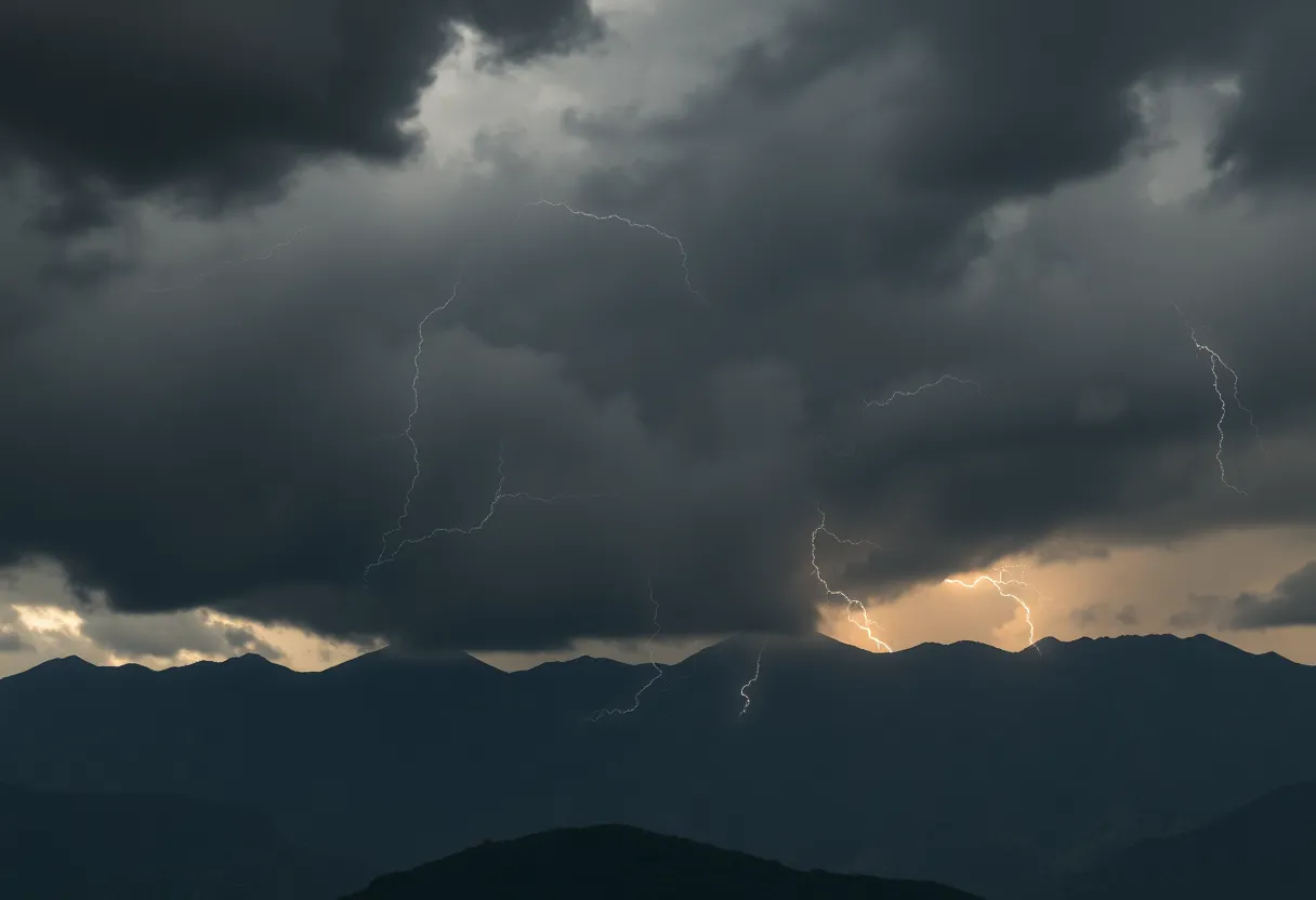
Severe thunderstorm warnings have been issued for the Oconee Mountains and surrounding area, effective until 10:30 p.m. This storm brings strong winds and potential hail, causing safety concerns for residents. Important precautions are urged as the storm approaches, especially for those in Mountain City, Westminster, and other nearby communities. Keep safe indoors and stay updated on weather alerts.
Severe Thunderstorm Warnings Issued for Oconee Mountains and Greater Oconee Region
Hey there, folks! If you’re in or around the lovely city of Oconee, you might want to grab a cup of tea, sit back, and take note. The weather brewing up in our beautiful area isn’t looking too pretty right now! As of Friday night at around 9:47 p.m., the National Weather Service has issued a severe thunderstorm warning specifically for the Oconee Mountains and the greater Oconee region that will be effective until 10:30 p.m.
What’s Coming Your Way?
The forecast isn’t exactly bringing sunshine and rainbows. Get ready for some fierce weather, as this storm could unleashing winds gusting up to 55 mph—that’s strong enough to knock over tree limbs and send your lawn decorations flying. And if you’ve ever wondered what penny-sized hail feels like, you might soon find out—expect hail to reach a size of about 0.75 inches! Ouch!
Where Could This Affect You?
Residents of Mountain City, Westminster, Long Creek, Bad Creek, Avalon, Oakway, Tiger, Cornelia, Lake Burton, and Devils Fork State Park should especially be aware and prepare themselves for the impending storm. It seems that Doppler radar has tracked a strong thunderstorm near Clayton, and that is moving northeast at a swift 40 mph—so it’s headed towards our neck of the woods.
Get Inside!
If you happen to be outdoors, it’s a great time to seek shelter inside a building! You definitely don’t want to get caught outside during a thunderstorm. Those gusty winds and hail could cause some minor but damaging issues for outdoor objects and property. It’s not worth the risk! Just imagine your favorite patio chair tumbling across the lawn. To prevent any injuries, make sure to find a safe place inside until this storm passes.
The Dangers of Thunderstorms
Now, let’s talk about lightning. Did you know that lightning strikes the United States around 25 million times annually? That’s mostly during the summer months, which also leads to about 20 fatalities each year. So, as the storm rolls in, keep in mind that the likelihood of lightning is definitely on the rise. The closer the storm gets, the more you should take precautions. If you can’t find an indoor shelter, certain safety measures can help you stay protected.
And let’s not forget about the roads! As thunderstorm rains start to fall, hydroplaning can become a real hazard. This occurs when a vehicle loses traction on wet roads, sliding uncontrollably due to the buildup of water in front of the tires. It’s all about that pesky water pressure, which can make your vehicle rise on a thin layer of water—in other words, a recipe for disaster on the roads!
Stay Safe and Informed
As the warning is set to expire at 10:30 p.m., it’s crucial for everyone to stay updated and safe. Severe storms can create incredibly damaging conditions, and the safety of our local community should always come first! Keep an eye on those weather forecasts, and be sure to follow any advice given to minimize risks. Stay safe out there! 🌩️
Deeper Dive: News & Info About This Topic
HERE Resources
Severe Thunderstorm Warnings Issued for South Carolina
Brace Yourselves, Greenville! Thunderstorms Approaching
Severe Thunderstorm Warnings for Greenville and Spartanburg
Severe Thunderstorms Cause Chaos in Southeastern States
Severe Thunderstorm Warning Hits Lowcountry
Severe Thunderstorm Warning for Oconee County
Severe Thunderstorms Rolling Into Upstate South Carolina
Severe Weather Alert for Upstate SC: Thunderstorms and Tornadoes Expected
Severe Thunderstorm Warning Issues in Upstate South Carolina
Additional Resources
- Island Packet: Severe Thunderstorm Warning
- Wikipedia: Thunderstorm
- Fox 5 Atlanta: Severe Weather Threat
- Google Search: Severe Weather
- Myrtle Beach Online: Weather News
- Google Scholar: Storm Safety
- WSBTV: Winter Storm Watch
- Encyclopedia Britannica: Weather Safety
Author: STAFF HERE HILTON HEAD
The HILTON HEAD STAFF WRITER represents the experienced team at HEREHiltonHead.com, your go-to source for actionable local news and information in Hilton Head Island, Beaufort County, and beyond. Specializing in "news you can use," we cover essential topics like product reviews for personal and business needs, local business directories, politics, real estate trends, neighborhood insights, and state news affecting the area—with deep expertise drawn from years of dedicated reporting and strong community input, including local press releases and business updates. We deliver top reporting on high-value events such as the RBC Heritage golf tournament, Hilton Head Island Wine & Food Festival, and the Gullah Celebration. Our coverage extends to key organizations like the Hilton Head Island-Bluffton Chamber of Commerce and Community Foundation of the Lowcountry, plus leading businesses in tourism and hospitality that power the local economy such as Sea Pines Resort and Sonesta Resort Hilton Head Island. As part of the broader HERE network, including HEREAiken.com, HEREBeaufort.com, HEREChapin.com, HERECharleston.com, HEREClinton.com, HEREColumbia.com, HEREGeorgetown.com, HEREGreenwood.com, HEREGreenville.com, HEREHiltonHead.com, HEREIrmo.com, HEREMyrtleBeach.com, HERENewberry.com, HERERockHill.com, and HERESpartanburg.com, we provide comprehensive, credible insights into South Carolina's dynamic landscape.


