News Summary
Residents in Greenville and Spartanburg counties are urged to prepare for severe thunderstorms this Sunday evening. The National Weather Service has issued warnings for strong rain, hail, and wind gusts, with the storm expected to affect several areas. As conditions escalate with potential wind gusts of 60 mph and quarter-size hail, safety measures are crucial. Citizens should secure outdoor items and seek shelter until the storm passes.
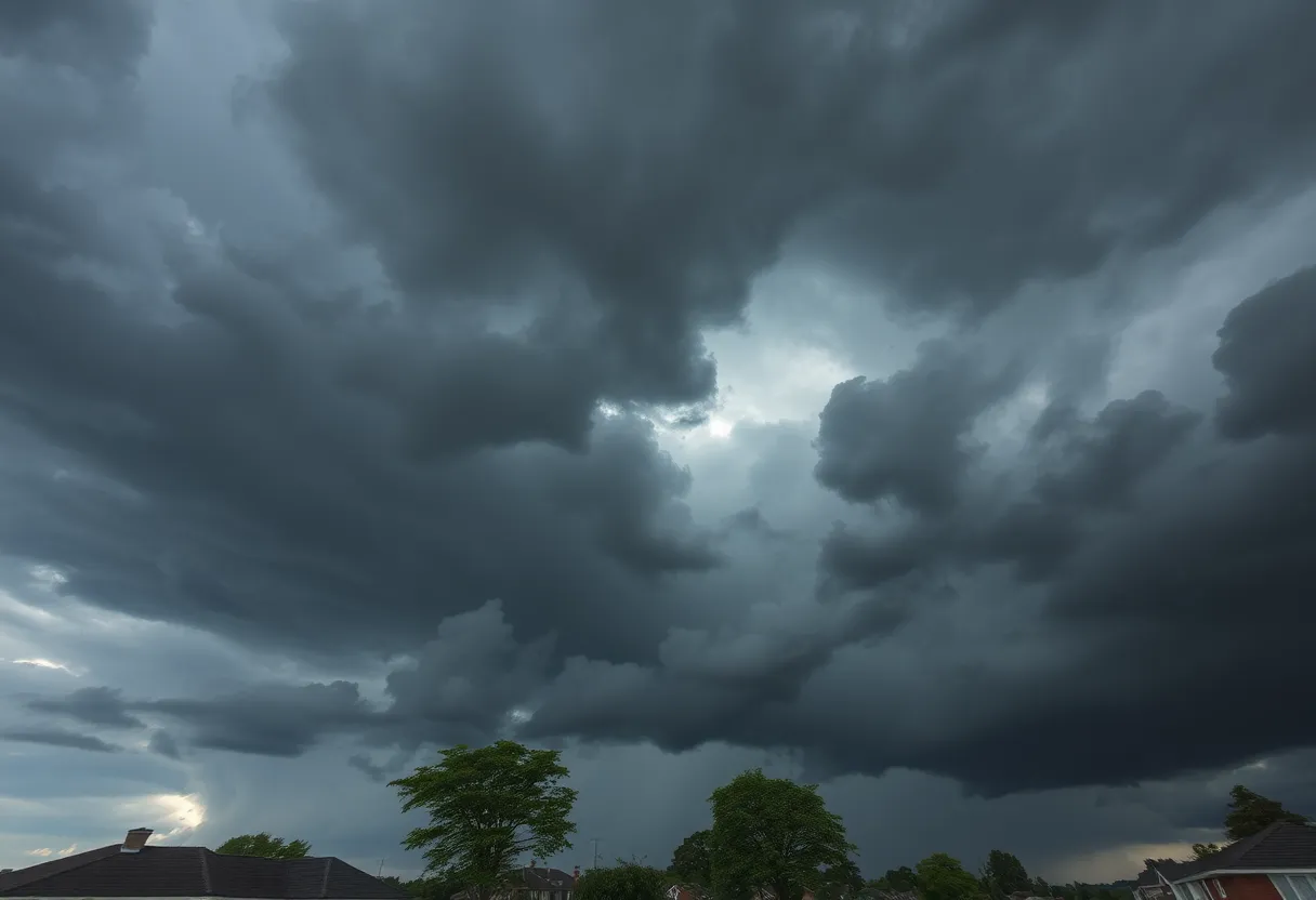
Severe Thunderstorm Warning Rumbles Through Greenville and Spartanburg
Batten down the hatches, folks! Residents of Greenville and Spartanburg counties should brace themselves as severe thunderstorms are rolling into town, causing quite a stir this Sunday evening. The National Weather Service (NWS) issued alerts throughout the area, leaving no stone unturned for thunderstorm enthusiasts—or, more accurately, safety-conscious residents. At precisely 5:33 p.m., the NWS sounded the alarm for strong thunderstorms expected to last until 6:00 p.m. This is not just your usual summer downpour!
What to Expect
As these fierce clouds gather, they’re likely to unleash pea-sized hail measuring about 0.25 inches alongside wind gusts reaching a notable 40 mph. Just at 5:32 p.m., Doppler radar indicated a strong thunderstorm forming about 13 miles northeast of downtown Greenville, near Greer. This storm is moving southeast at 30 mph, and forecasters urge everyone to pay attention.
What does this mean for you? Well, if you have outdoor items sitting around, it might be a good time to secure them. Gusty winds could knock down tree limbs, and blowing unsecured objects can be a nuisance, if not dangerous. So, keep your garden gnomes and patio furniture in check!
Where Is This Storm Headed?
The storm is set to affect several areas, including Reidville, Moore, Wellford, Roebuck, Lake Robinson, Lyman, Greer, Duncan, and the bustling GSP Airport. If you’re out and about, the best advice is to **seek shelter** inside a building. Better safe than drenched!
Upgraded Warnings on the Alarm!
That’s right, it’s shaping up to be quite the ride! If you’re in the thick of it, find a spot on the lowest floor of your building to stay as safe as possible. This warning will be in effect until 6:45 p.m., so keep your ears peeled and your phones charged!
Surviving the Storms
By 5:52 p.m., radar showed another severe thunderstorm positioned about 11 miles northeast of Greenville, close to Lake Robinson, making its way southeast at a slower pace of 15 mph. This storm promises to bring 60 mph wind gusts along with quarter-size hail!
Minor hail damage to vehicles is on the horizon, and residents can expect wind damage possibly affecting trees and power lines. Along with Reidville and Lake Robinson, areas like Five Forks, Taylors, and even Moore should stay alert as the storm approaches!
Be Wary of Lightning!
Do you know there are around 25 million lightning strikes in the U.S. each year, particularly during the summer? That’s a staggering number, leading to about 20 fatalities annually. Safety tip: when thunderstorms are brewing, the chances of getting struck increase significantly. So when those clouds roll in, it’s best to get indoors!
Driving Tips for the Storm
Don’t forget about those roads! Hydroplaning can become a serious issue during heavy rain. This happens when water builds up in front of your tires, making your vehicle slide out of control. Yikes! Pay attention to the road conditions, and if you find yourself hydroplaning, steer in the direction you want to go and avoid slamming on the brakes.
In conclusion, stay aware, keep an eye on your belongings, and prioritize safety until these storms pass. We’ll get through this together, and soon enough, we’ll be able to enjoy the warm weather again without the thundering skies overhead. Let’s hope for a smooth and swift end to these tumultuous storms!
Deeper Dive: News & Info About This Topic
HERE Resources
Marlboro County Prepares for Severe Thunderstorms
Thunderstorm Alert Issued for Chesterfield County
Traffic Challenges Rise in Hilton Head Island
Severe Thunderstorm Warnings Impact Central and Southeastern Orangeburg County
Severe Thunderstorms and Tornado Warning in Rock Hill, SC
Hilton Head Island Celebrates Beach Recognition and Dog Restrictions
Severe Thunderstorm Warnings Affect Florence and Surrounding Areas
Severe Thunderstorm Warning for Southeastern Orangeburg
Severe Thunderstorm Warning Issued for Coastal Jasper and Beaufort County
Charleston, SC Faces Severe Weather Alerts and Flooding
Additional Resources
- Greenville Online
- Wikipedia: Severe Thunderstorm
- Herald Sun
- Google Search: Severe Weather Alerts
- Island Packet
- Google Scholar: Severe Weather Safety
- WYFF4 News
- Encyclopedia Britannica: Thunderstorms
Author: STAFF HERE HILTON HEAD
The HILTON HEAD STAFF WRITER represents the experienced team at HEREHiltonHead.com, your go-to source for actionable local news and information in Hilton Head Island, Beaufort County, and beyond. Specializing in "news you can use," we cover essential topics like product reviews for personal and business needs, local business directories, politics, real estate trends, neighborhood insights, and state news affecting the area—with deep expertise drawn from years of dedicated reporting and strong community input, including local press releases and business updates. We deliver top reporting on high-value events such as the RBC Heritage golf tournament, Hilton Head Island Wine & Food Festival, and the Gullah Celebration. Our coverage extends to key organizations like the Hilton Head Island-Bluffton Chamber of Commerce and Community Foundation of the Lowcountry, plus leading businesses in tourism and hospitality that power the local economy such as Sea Pines Resort and Sonesta Resort Hilton Head Island. As part of the broader HERE network, including HEREAiken.com, HEREBeaufort.com, HEREChapin.com, HERECharleston.com, HEREClinton.com, HEREColumbia.com, HEREGeorgetown.com, HEREGreenwood.com, HEREGreenville.com, HEREHiltonHead.com, HEREIrmo.com, HEREMyrtleBeach.com, HERENewberry.com, HERERockHill.com, and HERESpartanburg.com, we provide comprehensive, credible insights into South Carolina's dynamic landscape.


