News Summary
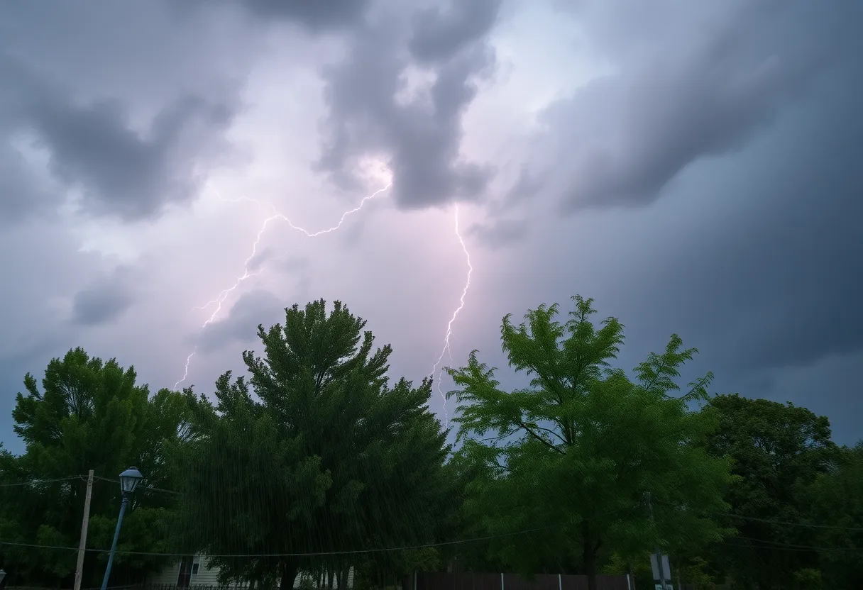
Residents of Chesterfield County are urged to take precautions as a severe thunderstorm warning has been issued, set to last until 9:45 p.m. tonight. The National Weather Service has identified storms moving rapidly northeast, with potential hail and wind gusts reaching dangerous levels. Various areas, including Cheraw and Society Hill, are likely to experience heavy impact. Residents should stay indoors and be aware of lightning and driving conditions as more storms are anticipated later this evening.
Severe Thunderstorm Warning Hits Chesterfield County!
Attention, Chesterfield County residents! Mother Nature is making her presence felt with a serious weather alert you need to know about. An official severe thunderstorm warning has been issued, and it’s set to stay in effect until 9:45 p.m. tonight. If you’re planning to step outside, it’s time to rethink those plans and perhaps head indoors!
What to Expect?
As the thunderstorm rolls in, brace yourself for some wild weather! The National Weather Service has tracked severe thunderstorms on Doppler radar, noting a straight-line of storms stretching from near Wallace all the way to North Hartsville. These storms are moving towards the northeast at a brisk pace of 40 mph, so they’re not wasting any time!
Prepare for hail that may be as big as marble-sized – around half an inch – and wind gusts that could whip up to 50 mph. This kind of wind can easily knock down tree limbs and send any unsecured outdoor items flying around. So, it might be a good idea to secure anything that could potentially become a projectile!
Where Will It Hit?
Areas like Cheraw, Society Hill, Patrick, and even the Cheraw Fish Hatchery are expected to feel the brunt of this storm. Make sure you stay informed if you live in these areas, and seek shelter if you find yourself outside. Safety first, right?
Lightning and Safety Tips
Have you ever heard that around 25 million lightning strikes hit the U.S. every year? Yes, you read that right! During thunderstorms, lightning strikes peak when the storm is directly overhead and it’s responsible for about 20 fatalities each year. So, when you hear thunder rumbling, take it seriously and find a sturdy building to wait it out.
Driving Caution
If you’re driving, be extra careful too! With the rain pouring, roads might become slippery, and you’re at risk of hydroplaning. This happens when your tires lose contact with the road due to water buildup. Keep a close eye on the road conditions, reduce your speed, and avoid sudden movements with your steering wheel.
What’s Coming Next?
Just when you thought it couldn’t get any wilder, a cold front is expected to sweep through this evening, bringing more showers and possibly additional thunderstorms. Reports are already pouring in about trees down in nearby Buckingham, Chesterfield, and Cumberland counties, and there have been instances of quarter-sized hail in Chesterfield County too!
A new severe thunderstorm warning has also been issued for areas that include Amelia, NW Chesterfield, and others until 10 p.m. This alert warns of potential wind gusts up to 60 mph and penny-sized hail. Whether you’re in Richmond or the outskirts, it’s a time to be aware!
Wrap-Up!
Even though the storms will start winding down by midnight, don’t think you’re out of the woods just yet! Showers are likely to stick around, in addition to breezy conditions with wind gusts ruffling through at 30-40 mph throughout the day. Keep your weather apps close, and stay updated as we provide continuous information through channels like the First Alert Weather app.
In conclusion, everyone in Chesterfield County should stay alert and safe this evening. So grab a cozy blanket, tune into the weather updates, and cuddle up indoors until the storm passes! Stay safe!
Deeper Dive: News & Info About This Topic
HERE Resources
Severe Thunderstorm Warnings for Oconee Region
Severe Thunderstorm Warnings Issued for South Carolina
Brace Yourselves, Greenville! Thunderstorms Approaching
Severe Thunderstorm Alerts Hit Greenville and Nearby Counties
Severe Thunderstorm Warnings for Greenville and Spartanburg
Severe Thunderstorms Cause Chaos in Southeastern States
Severe Thunderstorm Warning Hits Lowcountry
Beaufort County to Launch 2025 Pavement Rejuvenation Program
Severe Thunderstorm Warning for Oconee County
Severe Thunderstorms Rolling Into Upstate South Carolina
Additional Resources
- Island Packet: Weather News
- 12 On Your Side: Severe Storm Threat
- WRIC: Snow Storm Crashes
- WBTV: Severe Weather Alerts
- WCCB Charlotte: Storm Damage
- Wikipedia: Weather Warning
- Google Search: Severe Thunderstorm Warning
- Google Scholar: Severe Weather Alerts
- Encyclopedia Britannica: Weather
- Google News: Thunderstorm Alerts
Author: STAFF HERE HILTON HEAD
The HILTON HEAD STAFF WRITER represents the experienced team at HEREHiltonHead.com, your go-to source for actionable local news and information in Hilton Head Island, Beaufort County, and beyond. Specializing in "news you can use," we cover essential topics like product reviews for personal and business needs, local business directories, politics, real estate trends, neighborhood insights, and state news affecting the area—with deep expertise drawn from years of dedicated reporting and strong community input, including local press releases and business updates. We deliver top reporting on high-value events such as the RBC Heritage golf tournament, Hilton Head Island Wine & Food Festival, and the Gullah Celebration. Our coverage extends to key organizations like the Hilton Head Island-Bluffton Chamber of Commerce and Community Foundation of the Lowcountry, plus leading businesses in tourism and hospitality that power the local economy such as Sea Pines Resort and Sonesta Resort Hilton Head Island. As part of the broader HERE network, including HEREAiken.com, HEREBeaufort.com, HEREChapin.com, HERECharleston.com, HEREClinton.com, HEREColumbia.com, HEREGeorgetown.com, HEREGreenwood.com, HEREGreenville.com, HEREHiltonHead.com, HEREIrmo.com, HEREMyrtleBeach.com, HERENewberry.com, HERERockHill.com, and HERESpartanburg.com, we provide comprehensive, credible insights into South Carolina's dynamic landscape.


