News Summary
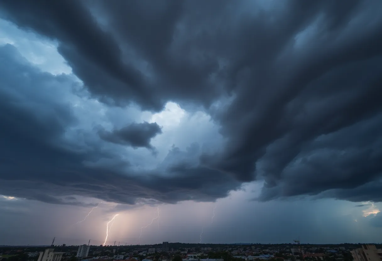
Charleston, SC, is under severe thunderstorm warnings as the National Weather Service alerts residents of strong thunderstorms with wind gusts up to 50 mph. The storm system is moving southeast, affecting areas including North Charleston, Summerville, and Goose Creek. Residents should prepare for possible flash flooding and stay informed through local sources. It’s a critical time to secure outdoor items and have safety plans in place due to the unpredictable nature of severe weather.
Severe Thunderstorm Warnings Blank Charleston Area: Stay Safe and Prepare!
Charleston, SC, is bracing for some **heavy weather** as the National Weather Service (NWS) has sounded the alarm on severe thunderstorms. The latest weather alert was issued on Wednesday at 6:16 p.m., warning residents in Inland Berkeley, Tidal Berkeley, Dorchester, and Charleston counties of strong thunderstorms, which will be effective until 6:45 p.m. Buckle up, folks, it’s going to be a wild ride!
What Can You Expect?
Residents should be prepared for **wind gusts** reaching up to 50 mph! This storm system was tracked just near Crowfield Plantation, moving southeast at about 10 mph as of 6:16 p.m. The NWS is cautioning that these gusty winds can easily knock down tree limbs and send unsecured objects flying around. It’s a good time to check that your patio furniture is secured!
Areas Impacted
If you live in North Charleston, Summerville, Goose Creek, Hanahan, Ladson, Naval Weapons Station Charleston, West Ashley, Crowfield Plantation, College Park, or Sangaree, it’s time to pay attention. And don’t forget about I-26 – the storm warning includes stretches between mile markers 198 and 212. Just a heads up, that could impact your commute if you’re out and about.
Flash Flooding Risks
But it’s not just the wind you should be worried about! Torrential rainfall is accompanying this storm, increasing the risk of flash flooding. If you’re out driving, now is *not* the moment to test your luck. Make sure to avoid flooded roadways – they can be deceptively dangerous!
Stay Updated!
In times like these, it’s crucial to stay in the loop! Keep an eye on your NOAA Weather Radio, local television channels, or community news sources for important updates from the NWS. Information can change quickly, so it’s wise to have your favorite weather app handy.
Additional Alerts
As a reminder, an earlier severe thunderstorm warning for Charleston County went into effect at 6:02 p.m. on Monday, set to continue until 6:30 p.m. With anticipated wind gusts expecting to soar up to 60 mph, damage to roofs, siding, and trees is likely, according to reports of severe thunderstorm activity near McClellanville. This includes areas like Awendaw, Lighthouse Island, Cape Romain, and more.
How to Stay Safe
When severe weather hits, it’s all about safety. The NWS advises seeking shelter in a sturdy building. Stay away from windows and make sure to have a safety plan in place for your family. It’s also worth noting that thunderstorms bring a significant risk of lightning. Did you know that around 25 million lightning strikes occur in the U.S. each year, mainly during the summer? It’s essential to be cautious around this unpredictable force of nature!
Hydroplaning: A Real Danger
For those hitting the roads, be extra careful. Hydroplaning can be a real danger when water accumulates faster than your tires can displace it, causing your vehicle to slide uncontrollably. Pay attention to road conditions and, most importantly, keep your speed in check to avoid this hazard.
Stay Informed and Prepared!
The NWS is emphasizing the importance of staying informed during severe weather events. Make sure to prepare ahead of time, as conditions can change rapidly. Charleston residents, let’s stay safe and ride out this storm together!
Deeper Dive: News & Info About This Topic
HERE Resources
Severe Thunderstorm Warning Issued for Orangeburg County
Beaufort County Sheriff’s Office Seeks Austin Jared Radel
Intensified Search for Wanted Individual in Hilton Head Island
Severe Thunderstorms Expected in Abbeville and Greenwood
Aiken County Faces Severe Thunderstorm Warnings – Stay Safe!
Severe Thunderstorm Warning Issued for Greenville-Spartanburg Area
Severe Thunderstorms and Flood Warnings Hit Charleston Area
Columbia Residents Prepare for Severe Thunderstorms
Severe Weather Alert for South Carolina: Strong Thunderstorms Expected
Severe Thunderstorms Hit Central and Southeastern South Carolina
Additional Resources
- Count on 2
- Wikipedia: Thunderstorm
- Island Packet
- Google Search: Severe weather Charleston
- Post and Courier
- Google Scholar: Severe thunderstorm warnings
- ABC News 4
- Encyclopedia Britannica: Thunderstorm
- Live 5 News
- Google News: Thunderstorm Charleston
Author: STAFF HERE HILTON HEAD
The HILTON HEAD STAFF WRITER represents the experienced team at HEREHiltonHead.com, your go-to source for actionable local news and information in Hilton Head Island, Beaufort County, and beyond. Specializing in "news you can use," we cover essential topics like product reviews for personal and business needs, local business directories, politics, real estate trends, neighborhood insights, and state news affecting the area—with deep expertise drawn from years of dedicated reporting and strong community input, including local press releases and business updates. We deliver top reporting on high-value events such as the RBC Heritage golf tournament, Hilton Head Island Wine & Food Festival, and the Gullah Celebration. Our coverage extends to key organizations like the Hilton Head Island-Bluffton Chamber of Commerce and Community Foundation of the Lowcountry, plus leading businesses in tourism and hospitality that power the local economy such as Sea Pines Resort and Sonesta Resort Hilton Head Island. As part of the broader HERE network, including HEREAiken.com, HEREBeaufort.com, HEREChapin.com, HERECharleston.com, HEREClinton.com, HEREColumbia.com, HEREGeorgetown.com, HEREGreenwood.com, HEREGreenville.com, HEREHiltonHead.com, HEREIrmo.com, HEREMyrtleBeach.com, HERENewberry.com, HERERockHill.com, and HERESpartanburg.com, we provide comprehensive, credible insights into South Carolina's dynamic landscape.


