News Summary
The National Weather Service has issued a severe thunderstorm warning for Spartanburg County, with intense storms expected to bring pea-sized hail and wind gusts up to 40 mph. Residents are advised to seek shelter and be cautious of potential hazards from high winds and hail. Areas at risk include Boiling Springs, Cowpens, and Inman. Previous storms in the region have already caused significant damage, underscoring the importance of heeding warnings and staying safe indoors during severe weather.
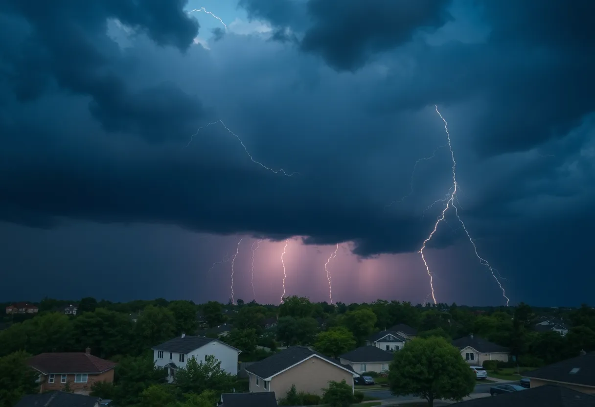
Severe Thunderstorm Warnings Issued for Spartanburg County
The city of Spartanburg is gearing up for some wild weather as the National Weather Service (NWS) Greenville-Spartanburg SC has issued a weather alert for strong thunderstorms. The alert, which went out on Saturday at 3:19 p.m., warns residents of intense thunderstorms rolling through the area until 3:45 p.m.
What to Expect
These thunderstorms are not just regular rain showers; they are packing some serious punch! Expect to see pea-sized hail measuring about 0.25 inches and wind gusts that could reach up to 40 mph. Radar has spotted a robust thunderstorm about 10 miles northwest of Spartanburg, near Boiling Springs, making its way eastbound at a brisk pace of 30 mph.
If you’re in the parks, driveways, or out running errands, be advised: those gusty winds can send tree limbs tumbling and tossing around any unsecured objects. Minor hail damage to outdoor items like chairs or decorations is also on the cards.
Areas At Risk
Several areas are included in this alert, particularly Boiling Springs, Cowpens, Inman, Mayo, Lake Bowen, Chesnee, and Fingerville. People in these locations should take the warning seriously. The NWS suggests that everyone find shelter indoors if they can. It’s just not worth the chance of getting caught outside when the storm hits.
Stay Safe Out There
As a reminder, thunderstorms bring increased risks, including lightning. In fact, around 25 million lightning strikes happen nationwide each year, mostly during the summer months, resulting in approximately 20 fatalities annually. When a thunderstorm approaches, it’s crucial to seek safety. The chance of getting struck by lightning goes up as the storm nears its peak. The best advice? Head inside.
Driving Precautions
Also, keep in mind that wet roads can be a serious issue. Drivers should be particularly cautious about hydroplaning, which occurs when a vehicle slides uncontrollably on wet surfaces due to water accumulating in front of the tires. The common culprits for hydroplaning include excessive speed, worn-out tires, and slippery road conditions. So, if you’re out driving in the rain, it’s best to slow down and stay alert.
Looking Back
Just to highlight how frequent severe weather can be in this area, on Thursday, July 10, there was another severe thunderstorm warning issued at 4:51 p.m. for Cherokee and Spartanburg counties. That storm brought winds as strong as 60 mph and quarter-sized hail. Locations like Spartanburg, Cowpens, Mayo, and Pacolet Mills felt the brunt of those storms.
When a severe thunderstorm warning is issued, it usually hints at winds reaching 58 mph or higher, or hail that’s at least 1 inch in diameter. Keeping informed means staying safe!
Stay Connected
If you notice damaging winds, hail, or flooding while you’re out and about, the NWS encourages you to report these incidents. You can do this by calling 1-800-267-8101 or through their social media channels.
So there you have it! As we prepare for today’s storms, remember to stay safe, heed the warnings, and take cover indoors if needed. Your safety is the top priority, and with just a little planning, we can all ride out the storm together!
Deeper Dive: News & Info About This Topic
HERE Resources
Severe Thunderstorm Warnings Issued for Charleston, SC
Hilton Head Island Launches Major Beach Renourishment Project
Severe Thunderstorms Strike Upstate South Carolina and Northeast Georgia
Beaufort County Pursues Funding for Hilton Head Bridge Project
Severe Thunderstorm Alert Issued for Marlboro and Dillon Counties
Severe Thunderstorm Warnings Issued for Spartanburg and Cherokee
Severe Thunderstorm Warnings Issued for Laurens County
Severe Thunderstorm Warnings Issued in South Carolina
Severe Thunderstorms Hit Pickens County
Severe Thunderstorm Warnings Issued for Anderson, SC
Additional Resources
- Goupstate: Severe Thunderstorm Warning for Spartanburg County
- Wikipedia: Thunderstorm
- Herald Online: Weather News
- Google Search: Severe Thunderstorm Safety
- Greenville Online: Severe Thunderstorm Warning
- Encyclopedia Britannica: Thunderstorm
- Fox Carolina: Damage Reported During Severe Storms
- Google News: Severe Weather Reports
Author: STAFF HERE HILTON HEAD
The HILTON HEAD STAFF WRITER represents the experienced team at HEREHiltonHead.com, your go-to source for actionable local news and information in Hilton Head Island, Beaufort County, and beyond. Specializing in "news you can use," we cover essential topics like product reviews for personal and business needs, local business directories, politics, real estate trends, neighborhood insights, and state news affecting the area—with deep expertise drawn from years of dedicated reporting and strong community input, including local press releases and business updates. We deliver top reporting on high-value events such as the RBC Heritage golf tournament, Hilton Head Island Wine & Food Festival, and the Gullah Celebration. Our coverage extends to key organizations like the Hilton Head Island-Bluffton Chamber of Commerce and Community Foundation of the Lowcountry, plus leading businesses in tourism and hospitality that power the local economy such as Sea Pines Resort and Sonesta Resort Hilton Head Island. As part of the broader HERE network, including HEREAiken.com, HEREBeaufort.com, HEREChapin.com, HERECharleston.com, HEREClinton.com, HEREColumbia.com, HEREGeorgetown.com, HEREGreenwood.com, HEREGreenville.com, HEREHiltonHead.com, HEREIrmo.com, HEREMyrtleBeach.com, HERENewberry.com, HERERockHill.com, and HERESpartanburg.com, we provide comprehensive, credible insights into South Carolina's dynamic landscape.


