News Summary
A severe thunderstorm warning has been issued for several counties in South Carolina, including Central Orangeburg and Bamberg. Residents should be aware of potential wind gusts up to 50 mph and pea-sized hail. Doppler radar indicates a strong storm moving southeast, posing risks to outdoor items and driving conditions. The National Weather Service advises seeking shelter and remaining cautious of lightning and flooding as the storm progresses.
Severe Thunderstorm Warning Hits South Carolina
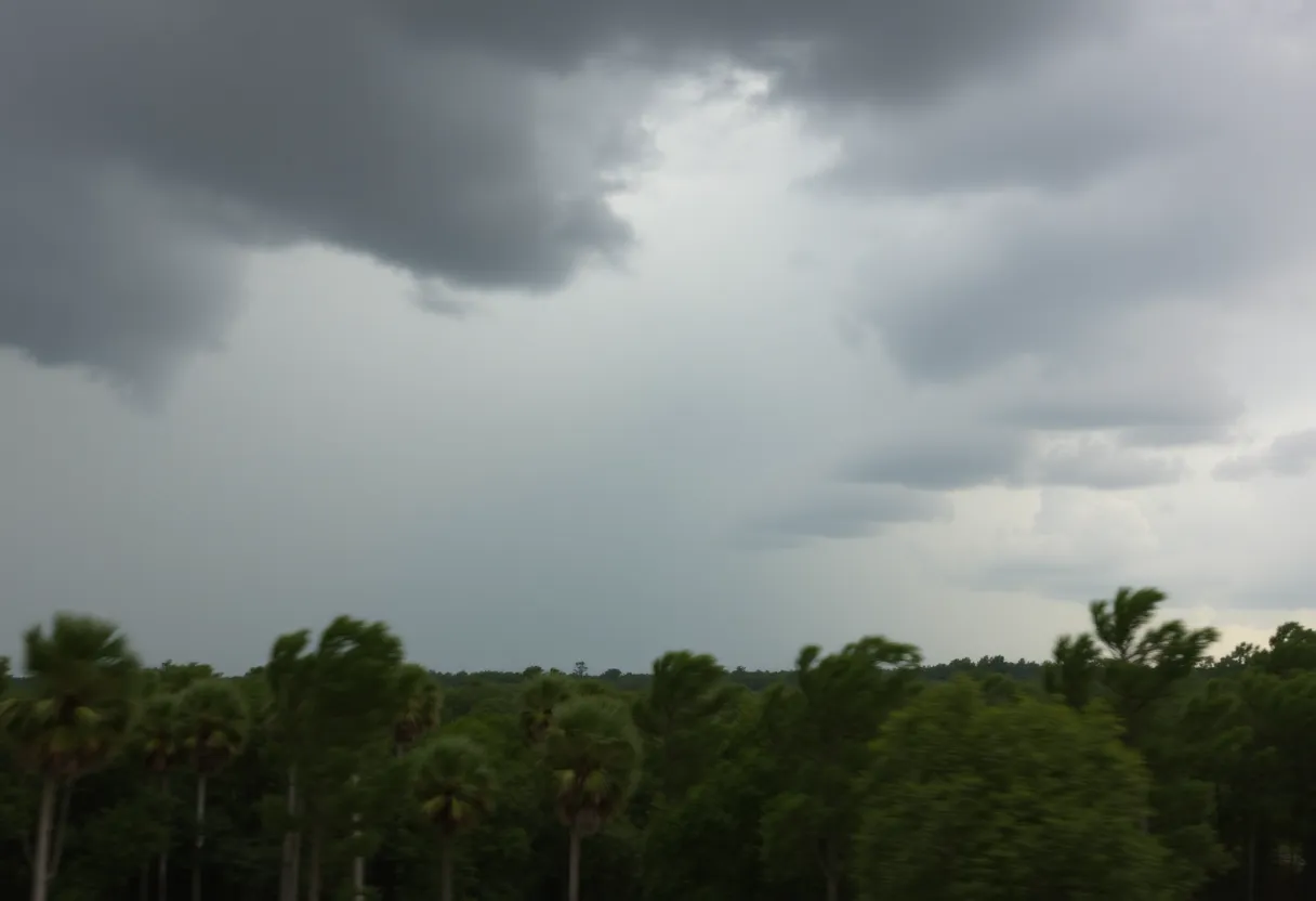
The skies over South Carolina are getting a little wild today! As of 4:20 p.m., the National Weather Service (NWS) has issued an updated severe thunderstorm warning that’s sending a shiver down the spine of residents across several counties. If you’re living in or around Central Orangeburg, Southeastern Orangeburg, Barnwell, Calhoun, or Bamberg counties, this news is especially for you!
What’s Coming Your Way?
This storm is no ordinary rain shower! With wind gusts soaring up to 50 mph, things are about to get breezy, to say the least. Not only that, but pea-sized hail—yep, that’s right, you heard it here—is also expected, measuring a cool 0.25 inches. Make sure to keep an eye out for any pesky little ice balls!
Current Thunderstorm Activity
Doppler radar has picked up a strong thunderstorm currently brewing near Bamberg, and it’s moving southeast at about 15 mph. This thunderstorm could potentially bring down tree limbs and send unsecured outdoor items flying, leading to minor damages—think misplaced patio furniture and toppled garden gnomes!
Which Areas Are Affected?
If you’re in or around the following locations, it’s time to be alert:
- Orangeburg
- Bamberg
- Denmark
- Branchville
- Bowman
- Elloree
- Orangeburg County Airport
- Rivers Bridge State Park
- Ehrhardt
- Hilda
- Rowesville
- Olar
- Kline
- Cordova
- Cope
- Govan
- Yonder Field
- Bamberg County Airport
- Edisto
If you’re hitting the highways, keep in mind that Interstate 26 (between mile markers 152 and 169) and Interstate 95 (between mile markers 85 and 90) are also in the storm’s path. Make sure to drive safely!
Safety First!
The NWS recommends that everyone seek shelter inside a building if they find themselves outdoors as the storm rolls in. And here’s a little tip: if you notice torrential rainfall, be cautious of potential localized flooding. It’s best to avoid driving on flooded roads—trust us, those puddles can be deeper than they look!
Keep an Eye on Lightning
We can’t forget about the lightning! This storm is likely producing frequent cloud-to-ground lightning, which can be dangerous as it can strike up to 10 miles away from the actual thunderstorm. In fact, did you know that about 25 million lightning strikes occur annually across the U.S., resulting in around 20 fatalities? Yikes! So, as a thunderstorm approaches, the risk of lightning strikes increases, peaking when the storm is right above us.
What Should You Do?
During thunderstorms, the best safety bet is to stay indoors or hop into a vehicle if you can’t find shelter. Remember, safety is the name of the game! Stay tuned for further updates, and let’s all hope this storm blows over soon so we can get back to sunny South Carolina days!
Deeper Dive: News & Info About This Topic
HERE Resources
Severe Thunderstorm Alert for Dillon, Florence, and Marion Counties
Severe Thunderstorm Warning Issued for Charleston Metro Area
Severe Thunderstorm Alert Issued for Berkeley and Dorchester County
High Surf Advisory Issued as Tropical Storm Chantal Approaches
Myrtle Beach Braces for Tropical Storm Chantal
Tropical Storms May Disrupt Independence Day Weekend in South Carolina
Rip Current Advisory Issued for Charleston County Beaches
Charleston Prepared as Tropical Depression Three Approaches
Tropical Depression 3 Develops Off the Southeastern U.S. Coast
Mixed Weather Expected This Fourth of July Weekend
Additional Resources
- Live 5 News
- Wikipedia: Thunderstorm
- ABC Columbia
- Google Search: severe thunderstorm
- The State
- Google Scholar: thunderstorm warning
- Island Packet
- Encyclopedia Britannica: thunderstorm
Author: STAFF HERE HILTON HEAD
The HILTON HEAD STAFF WRITER represents the experienced team at HEREHiltonHead.com, your go-to source for actionable local news and information in Hilton Head Island, Beaufort County, and beyond. Specializing in "news you can use," we cover essential topics like product reviews for personal and business needs, local business directories, politics, real estate trends, neighborhood insights, and state news affecting the area—with deep expertise drawn from years of dedicated reporting and strong community input, including local press releases and business updates. We deliver top reporting on high-value events such as the RBC Heritage golf tournament, Hilton Head Island Wine & Food Festival, and the Gullah Celebration. Our coverage extends to key organizations like the Hilton Head Island-Bluffton Chamber of Commerce and Community Foundation of the Lowcountry, plus leading businesses in tourism and hospitality that power the local economy such as Sea Pines Resort and Sonesta Resort Hilton Head Island. As part of the broader HERE network, including HEREAiken.com, HEREBeaufort.com, HEREChapin.com, HERECharleston.com, HEREClinton.com, HEREColumbia.com, HEREGeorgetown.com, HEREGreenwood.com, HEREGreenville.com, HEREHiltonHead.com, HEREIrmo.com, HEREMyrtleBeach.com, HERENewberry.com, HERERockHill.com, and HERESpartanburg.com, we provide comprehensive, credible insights into South Carolina's dynamic landscape.


