News Summary
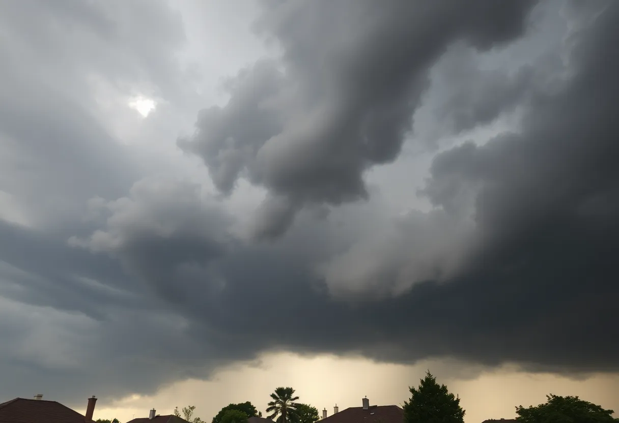
Residents in Upstate South Carolina are urged to take caution as a severe thunderstorm alert was issued late last night. Expect strong thunderstorms with gusts up to 40 mph and potential marble-sized hail. Areas including Abbeville, Laurens, and Greenwood counties should be prepared for lightning risks and safe driving tips due to possible hydroplaning conditions. Safety measures are crucial as warnings remain in effect today, with expectations of heavy rainfall and flash flooding. Stay indoors and prioritize safety as the storm approaches.
Severe Thunderstorm Alert for Upstate South Carolina
Attention, folks in Upstate South Carolina! A severe thunderstorm alert was issued last night at 11:50 p.m. by the local National Weather Service in Greenville-Spartanburg. If you live in Abbeville, Laurens, or Greenwood counties, it’s important to read on because there’s some wild weather headed your way!
What to Expect
The alert remains in effect until 12:15 a.m. today. Expect some strong thunderstorms that can pack quite a punch. We’re talking about wind gusts up to 40 mph—enough to make even the sturdiest of tree limbs think twice about hanging around. And if that doesn’t sound wild enough, there’s also the possibility of marble-sized hail—that’s about half an inch in diameter! So, those outdoor objects you have? They might want to take cover.
The radar was tracking a robust thunderstorm just 14 miles southwest of Laurens, near Ware Shoals, and it’s moving south at about 15 mph. This means that spots like Donalds, Cokesbury, Hodges, and Shoals Junction need to be on high alert. If you’re out and about, don’t forget: it’s wise to find shelter indoors while the storm rolls through.
Lightning Strikes: A Serious Concern
Now, let’s talk about something super important—lightning. Did you know that around 25 million lightning strikes occur in the U.S. every year, mostly during the summer months? That’s a staggering number! Unfortunately, lightning isn’t just flashy; it can be deadly. On average, about 20 fatalities happen each year due to lightning strikes. So, as the storm approaches, be extra cautious because the risk increases and it’s highest when the storm is directly overhead.
As the storm moves away, the chances of getting struck by lightning decrease. If you can’t find a safe place to wait it out indoors, make sure to stay clear of windows and avoid using electrical appliances—after all, it’s better to be safe than sorry!
Keep an Eye on the Roads
With these storms comes another concern—Road safety. You might have heard of hydroplaning; it’s when your vehicle loses control due to sliding on a layer of water on wet roads. This can happen quickly, and often when the water builds up in front of your tires faster than your car can push it away. Cars can literally ride on water! So, if you’re driving during heavy rains, ensure you drive cautiously.
Stay Prepared and Safe
Going into today, multiple severe thunderstorm warnings are in effect for various counties in the region. Expect heavy rainfall, intense winds, hail, and the potential for flash flooding. Safety precautions are vital during severe weather. If things start looking rough, it’s best to hightail it to an interior room on the lowest floor of your building. And if you come across any damaged roads or public facilities, please report it!
So, Upstate South Carolina, keep your eyes on the sky, stay safe, and prepare for a wild night! Keep your loved ones close, and let’s hope for clear skies ahead soon!
Deeper Dive: News & Info About This Topic
HERE Resources
York County Faces Severe Thunderstorms and Flash Flooding
Severe Thunderstorm Warnings Hit Upstate SC and Northeast GA
Bamberg, SC Faces Recovery Challenges After Devastating Tornado
Severe Thunderstorm Warning Hits Fairfield County
Severe Thunderstorms Expected in South Carolina
Thunderstorm Alerts Issue for Darlington County
Severe Thunderstorm Warning in Cherokee and Spartanburg Counties
Severe Thunderstorm Warning Issued for Columbia Area
Severe Thunderstorm Warnings Hit York County
Severe Thunderstorm Warning in York County, SC
Additional Resources
- Island Packet: Severe Thunderstorm Alert
- Wikipedia: Thunderstorm
- Herald Online: Thunderstorm Update
- Google Search: Thunderstorm Safety
- WBTV: Severe Thunderstorm Warning
- Encyclopedia Britannica: Thunderstorm
- Greenville Online: Greenville Severe Thunderstorm Warning
- Google News: Severe Weather
Author: STAFF HERE HILTON HEAD
The HILTON HEAD STAFF WRITER represents the experienced team at HEREHiltonHead.com, your go-to source for actionable local news and information in Hilton Head Island, Beaufort County, and beyond. Specializing in "news you can use," we cover essential topics like product reviews for personal and business needs, local business directories, politics, real estate trends, neighborhood insights, and state news affecting the area—with deep expertise drawn from years of dedicated reporting and strong community input, including local press releases and business updates. We deliver top reporting on high-value events such as the RBC Heritage golf tournament, Hilton Head Island Wine & Food Festival, and the Gullah Celebration. Our coverage extends to key organizations like the Hilton Head Island-Bluffton Chamber of Commerce and Community Foundation of the Lowcountry, plus leading businesses in tourism and hospitality that power the local economy such as Sea Pines Resort and Sonesta Resort Hilton Head Island. As part of the broader HERE network, including HEREAiken.com, HEREBeaufort.com, HEREChapin.com, HERECharleston.com, HEREClinton.com, HEREColumbia.com, HEREGeorgetown.com, HEREGreenwood.com, HEREGreenville.com, HEREHiltonHead.com, HEREIrmo.com, HEREMyrtleBeach.com, HERENewberry.com, HERERockHill.com, and HERESpartanburg.com, we provide comprehensive, credible insights into South Carolina's dynamic landscape.


