News Summary
Anderson and Abbeville counties are under a severe thunderstorm warning until 11:45 p.m. Residents should secure belongings and stay informed as strong winds, lightning, and heavy rainfall are expected. Doppler radar shows a powerful storm moving east at 50 mph, with gusts hitting 40 mph. Possible flash flooding poses additional risks. This warning highlights the need for preparedness against potential power outages and hazardous conditions on the roads. Stay safe and informed as the storm progresses.
Severe Thunderstorm Warning in Anderson and Abbeville Counties!
This just in! Anderson and Abbeville counties are under a severe thunderstorm warning tonight, and residents need to be on high alert. The National Weather Service in Greenville-Spartanburg, SC, issued the warning at precisely 10:58 p.m., just a little while ago, and it remains in effect until 11:45 p.m. You heard that right—if you’re in these areas, it’s time to pay attention!
What to Expect
Conditions are shaking up as Doppler radar has tracked a powerful thunderstorm located about 5 miles west of Hartwell. This storm is moving east at an astonishing pace of 50 mph. With it comes a forecast of wind gusts that could hit speeds of up to 40 mph. Now, that’s some serious wind force!
Residents in and around locales such as Hartwell, Carnesville, Homeland Park, Royston, Reed Creek, Lavonia, Iva, Bowman, Lake Secession, and Canon should pay special attention. Those gusty winds have the potential to knock down tree limbs and throw around any unsecured objects. So make sure to secure your outdoor stuff—your patio furniture may not survive a tornado!
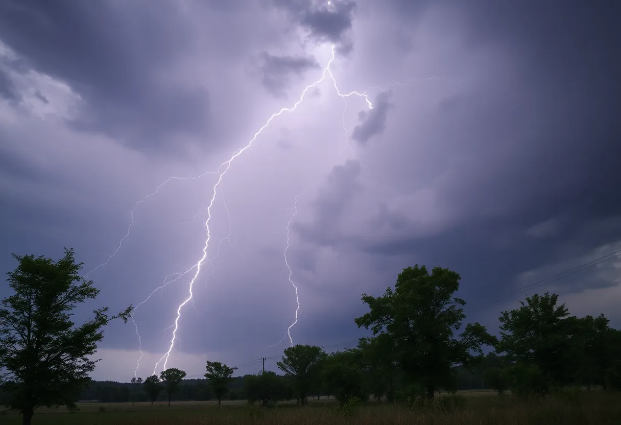
Lightning Danger
It’s not just the wind that’s a concern. This thunderstorm is also unleashing frequent cloud-to-ground lightning. Trust us when we say, if you’re outdoors, you’ll want to seek shelter in a building ASAP. Remember that lightning can strike up to 10 miles away from a thunderstorm. In fact, around 25 million lightning strikes occur in the U.S. every single year, leading to about 20 fatalities. With that kind of track record, staying indoors sounds like a smart idea!
Rain and Flash Flooding Risks
There’s more! Heavy rainfall is anticipated alongside the storm, which brings along the potential for flash flooding. That’s right—especially if you’re in low-lying areas or near rivers. Water buildup can be hazardous, and one way to keep yourself safe on the roads is to watch out for hydroplaning. This occurs when your vehicle can’t push water away quickly enough, leading to a loss of control. So if the rain really starts coming down, consider delaying your travel until conditions improve.
Stay Informed and Prepared
With the NWS raising the threat levels for severe storms, it’s essential to stay updated on the latest weather alerts. In fact, we may see winds reaching speeds of 60 mph and hail as large as 1 inch in some areas. The impact on trees, power lines, and other structures could be substantial. Are you prepared for possible power outages? Now’s the time to make sure you’re ready!
If you do notice any significant weather impacts, don’t hesitate to report them through the proper channels. Sharing your observations helps keep everyone informed and can make a big difference in understanding the storm’s effects.
Final Thoughts
As the clock continues to tick towards 11:45 p.m., let’s ensure that we all do our part. If you’re in any of the warned areas, don’t take this storm lightly. Make sure you’re safe, secure, and taken care of. Whether it’s grabbing a cozy blanket to snuggle up or simply staying tuned in for updates, let’s weather this storm together. Stay safe, everyone!
Deeper Dive: News & Info About This Topic
HERE Resources
Severe Thunderstorm Warning Issued for Charleston Area
Myrtle Beach Residents on Alert for Thunderstorms
Severe Thunderstorm Alerts Hit Charleston as Rainfall Records Fall
Severe Thunderstorm Warning Issued for Charleston Area
Severe Weather Alert Issued for Hilton Head
Rain and Thunderstorms Expected in Hilton Head Area
Heads Up, Southeast Coast: Potential Low Pressure System on the Horizon!
Hazy Hilton Head Skies Illuminate the Week
Low Pressure System Brewing Off the Southeast Coast
Severe Weather Alert: Understanding Tornadoes in Oklahoma
Additional Resources
- Independent Mail: Severe Thunderstorm Warning for Anderson County
- Wikipedia: Thunderstorm
- Greenville Online: Greenville-Spartanburg Weather Forecast
- Google Search: Thunderstorm Warnings
- Myrtle Beach Online: Weather News Update
- Google Scholar: Severe Thunderstorm
- Knox News: Tornado Warning Issued
- Encyclopedia Britannica: Weather Warning
- 11 Now: Weather Alert Day for Severe Thunderstorms
- Google News: Severe Weather
Author: STAFF HERE HILTON HEAD
The HILTON HEAD STAFF WRITER represents the experienced team at HEREHiltonHead.com, your go-to source for actionable local news and information in Hilton Head Island, Beaufort County, and beyond. Specializing in "news you can use," we cover essential topics like product reviews for personal and business needs, local business directories, politics, real estate trends, neighborhood insights, and state news affecting the area—with deep expertise drawn from years of dedicated reporting and strong community input, including local press releases and business updates. We deliver top reporting on high-value events such as the RBC Heritage golf tournament, Hilton Head Island Wine & Food Festival, and the Gullah Celebration. Our coverage extends to key organizations like the Hilton Head Island-Bluffton Chamber of Commerce and Community Foundation of the Lowcountry, plus leading businesses in tourism and hospitality that power the local economy such as Sea Pines Resort and Sonesta Resort Hilton Head Island. As part of the broader HERE network, including HEREAiken.com, HEREBeaufort.com, HEREChapin.com, HERECharleston.com, HEREClinton.com, HEREColumbia.com, HEREGeorgetown.com, HEREGreenwood.com, HEREGreenville.com, HEREHiltonHead.com, HEREIrmo.com, HEREMyrtleBeach.com, HERENewberry.com, HERERockHill.com, and HERESpartanburg.com, we provide comprehensive, credible insights into South Carolina's dynamic landscape.


