News Summary
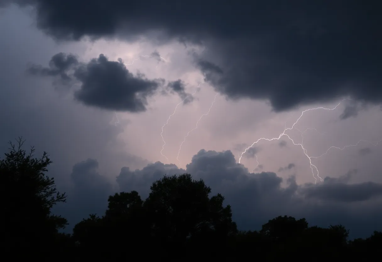
Charleston is currently under a Severe Thunderstorm Warning, as announced by the National Weather Service. Residents in areas such as Saint Stephen and Bonneau should prepare for strong winds, potential hail, and lightning. The storm is expected to produce gusts up to 60 mph and small hail, with a risk of isolated tornadoes. The warning remains in effect until 9 p.m. Stay updated and seek shelter if needed.
Severe Thunderstorm Warning Hits Lowcountry
The beautiful city of Charleston is bracing for some stormy weather as a Severe Thunderstorm Warning has been issued for several counties in the Lowcountry. The National Weather Service in Charleston made this announcement on Saturday at 6:43 p.m. It’s expected to remain in effect until 7:15 p.m. for areas such as Inland Berkeley, so if you’re in that region, it’s time to pay attention.
What to Expect
This strong thunderstorm is making its presence felt 6 miles southeast of Saint Stephen. With winds moving down from the west at a brisk 20 mph, residents should prepare for the potential of penny-sized hail, measuring around 0.75 inches. That’s some serious weather! And let’s not forget about those gusty winds that might knock down some tree limbs or send unsecured objects flying.
Impact Area
This storm doesn’t have a specific target, as it’s expected to impact several areas including Saint Stephen, Bonneau, Jamestown, Bonneau Beach, Northern Lake Moultrie, Calestown, Beufordtown, Farewell Corner, Bethera, and Alvin. If you’re in any of these spots, it’s wise to keep your ears perked for updates.
Safety First!
If you’re on or near Lake Moultrie, it’s time to exit the water and seek shelter in a sturdy building or your vehicle. Remember, lightning can strike up to 10 miles from a thunderstorm. If you’re able to hear the thunder, you’re close enough to be at risk for a strike.
Severe Thunderstorm Developments
Weather Watch
A severe thunderstorm watch is currently in effect until 9 p.m. for Charleston County, while Georgetown and Williamsburg Counties have a watch that extends until 10 p.m. This watch even covers Charleston Harbor and the coastal waters stretching from the South Santee River to Edisto Beach and out toward Savannah.
Extended Storm Threat
Risk Level and Warning
Wind and Hail Concerns
The forecasted gusts could reach speeds of 60 mph, which may lead to damaged trees and power outages, particularly affecting high-profile vehicles traveling on bridges. Hail could also be a concern with sizes potentially reaching up to one inch in diameter.
What Lies Ahead
Deeper Dive: News & Info About This Topic
HERE Resources
Beaufort County to Launch 2025 Pavement Rejuvenation Program
Severe Thunderstorm Warning for Oconee County
Severe Thunderstorms Rolling Into Upstate South Carolina
Severe Thunderstorm and Tornado Warnings Impact South Carolina and Atlanta
Severe Weather Alert as Thunderstorms Roll into Midlands, SC
Severe Thunderstorm Alert Issued for Saluda County
Severe Thunderstorms Hit Myrtle Beach, Prompting Warnings
Severe Thunderstorm Alert Issued for Newberry County
Powerful Thunderstorms Shake Chester County
Severe Weather Alert for Upstate SC: Thunderstorms and Tornadoes Expected
Additional Resources
- Live 5 News: Severe Thunderstorm Warnings in Lowcountry
- WYFF4: Severe Weather Timing in Greenville
- WVGazette Mail: Tornado Warning for Charleston Area
- Count on 2: Severe Storms Likely in South Carolina
- Weather.com: Severe Thunderstorm and Tornado Forecast
Author: STAFF HERE HILTON HEAD
The HILTON HEAD STAFF WRITER represents the experienced team at HEREHiltonHead.com, your go-to source for actionable local news and information in Hilton Head Island, Beaufort County, and beyond. Specializing in "news you can use," we cover essential topics like product reviews for personal and business needs, local business directories, politics, real estate trends, neighborhood insights, and state news affecting the area—with deep expertise drawn from years of dedicated reporting and strong community input, including local press releases and business updates. We deliver top reporting on high-value events such as the RBC Heritage golf tournament, Hilton Head Island Wine & Food Festival, and the Gullah Celebration. Our coverage extends to key organizations like the Hilton Head Island-Bluffton Chamber of Commerce and Community Foundation of the Lowcountry, plus leading businesses in tourism and hospitality that power the local economy such as Sea Pines Resort and Sonesta Resort Hilton Head Island. As part of the broader HERE network, including HEREAiken.com, HEREBeaufort.com, HEREChapin.com, HERECharleston.com, HEREClinton.com, HEREColumbia.com, HEREGeorgetown.com, HEREGreenwood.com, HEREGreenville.com, HEREHiltonHead.com, HEREIrmo.com, HEREMyrtleBeach.com, HERENewberry.com, HERERockHill.com, and HERESpartanburg.com, we provide comprehensive, credible insights into South Carolina's dynamic landscape.


