News Summary
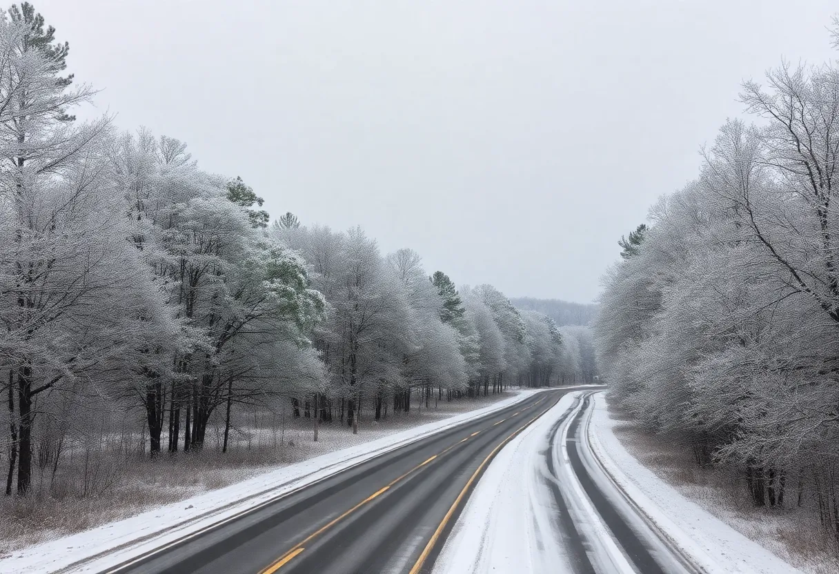
South Carolina is preparing for a winter weather event as a winter weather advisory is issued, forecasting snow and ice accumulation midweek. With temperatures plummeting, snow showers are expected to create hazardous conditions. Residents are urged to dress in layers and take precautions against freezing temperatures. A winter storm watch is also in place for later in the week, potentially leading to challenging travel conditions. The weather is expected to improve by the weekend, but risks of black ice remain a concern.
South Carolina is bracing for a winter weather event as a winter weather advisory has been issued in anticipation of snow and ice accumulating midweek. Snow showers began Tuesday afternoon along and south of Interstate 85, with expectations for continued flurries until around 7 p.m. Tuesday. Accumulations in areas south of I-85 are forecasted to range from a quick dusting up to 1 inch.
Temperatures across the region are expected to plummet, with lows dropping to 14°F in the Upstate and a chilling 5°F in Asheville. Wednesday is anticipated to be a sunny yet frigid day, with temperatures hovering near the freezing mark. The forecast indicates that Thursday will see a slight warm-up, with temperatures expected to reach around 40°F. By Friday through Sunday, temperatures may rise into the mid-40s.
Residents are advised to adopt safety measures against freezing temperatures by dressing in multiple layers and ensuring that extremities are covered if spending extended time outdoors. These precautions are especially important for individuals who have previously experienced issues with frozen pipes.
Upcoming Weather Forecasts
A winter storm watch is in place for Friday, signaling potential sleet, snow, and ice accumulations that could make travel hazardous. Thursday morning could see dangerously cold conditions with temperatures in the teens and 20s, compounded by winds in the mountainous regions reaching 10 to 15 mph, and gusts as high as 30 mph. This could create feels-like temperatures dipping into single digits or below zero throughout the area.
Snow showers are expected to advance into the western mountains and northeast Georgia after 9 AM Wednesday, becoming widespread across the Western Carolinas by noon. The initial precipitation is likely to start as snow, transitioning into the afternoon and early evening hours, before a potential switch to sleet and freezing rain for southern Upstate areas after 6 PM. Northern and central Upstate regions may see total snow accumulations ranging from 1 to 3 inches, while southern Upstate locations could accumulate a trace up to 2 inches. Ice accumulation in southern Upstate areas is projected to be as much as 0.25 inches.
Regional Impacts
Western North Carolina may bear the brunt of the storm, with predictions for snow totals reaching 3 to 6 inches, prompting a winter storm watch for these areas. By late Wednesday night, the snow and freezing rain are expected to taper off, with conditions improving by about 2 AM for most regions. However, road conditions are likely to remain challenging and icy into Saturday morning until temperatures climb above freezing, with warming projected between 10 AM and 11 AM on Saturday.
The potential for black ice is a concern Saturday night into Sunday as lingering moisture or melted snow may refreeze. A winter weather advisory specifically for the Midlands, including Kershaw and Lee counties, will take effect at 11 a.m. Wednesday as rain is expected to precede any snow or wintry mix, which may include freezing rain and sleet.
Long-Term Outlook
Columbia is forecasted to see an overnight low of 19 degrees, potentially leading to further concerns regarding refreeze and black ice. Over the following days, daytime temperatures are projected to rise from the 40s on Thursday and Friday to the 50s throughout the weekend. Looking further ahead, a heat wave is anticipated early next week, with temperatures possibly reaching up to 71 degrees.
This possible snow event could mark the third snowstorm in 2025 for the Midlands, with the last recorded snowfall in Columbia occurring in January 2022, alongside significant snowfall earlier in January 2025.
Deeper Dive: News & Info About This Topic
- WYFF4: South Carolina Snow Forecast
- Fox Carolina: Mainly Snow and Ice Possible
- The State: Weather News and Updates
- Greenville Online: Snow Forecast for Upstate
- WISTV: Treacherous Travel Ahead
- Wikipedia: Weather
- Google Search: Snow Forecast South Carolina
- Google Scholar: Winter Weather Impact
- Encyclopedia Britannica: Weather
- Google News: Winter Storm South Carolina

Author: STAFF HERE HILTON HEAD
The HILTON HEAD STAFF WRITER represents the experienced team at HEREHiltonHead.com, your go-to source for actionable local news and information in Hilton Head Island, Beaufort County, and beyond. Specializing in "news you can use," we cover essential topics like product reviews for personal and business needs, local business directories, politics, real estate trends, neighborhood insights, and state news affecting the area—with deep expertise drawn from years of dedicated reporting and strong community input, including local press releases and business updates. We deliver top reporting on high-value events such as the RBC Heritage golf tournament, Hilton Head Island Wine & Food Festival, and the Gullah Celebration. Our coverage extends to key organizations like the Hilton Head Island-Bluffton Chamber of Commerce and Community Foundation of the Lowcountry, plus leading businesses in tourism and hospitality that power the local economy such as Sea Pines Resort and Sonesta Resort Hilton Head Island. As part of the broader HERE network, including HEREAiken.com, HEREBeaufort.com, HEREChapin.com, HERECharleston.com, HEREClinton.com, HEREColumbia.com, HEREGeorgetown.com, HEREGreenwood.com, HEREGreenville.com, HEREHiltonHead.com, HEREIrmo.com, HEREMyrtleBeach.com, HERENewberry.com, HERERockHill.com, and HERESpartanburg.com, we provide comprehensive, credible insights into South Carolina's dynamic landscape.


