
News Summary The South Carolina community mourns the loss of 12-year-old Jaysen Carr, who died after contracting a brain-eating amoeba from swimming in Lake Murray. His tragic death has raised...

News Summary South Carolina forward Ashlyn Watkins plans to take the entire upcoming basketball season off due to recovery from an ACL injury. The announcement allows the coaching staff to...

News Summary A radioactive wasp nest has been found at the Savannah River Site in South Carolina, emitting radiation levels significantly exceeding federal limits. Discovered by Radiological Control Operations, the...

News Summary Two deputies from the Greenville County Sheriff’s Office were injured during a SWAT training exercise when live rounds were reportedly used. One deputy was shot in the shoulder...

News Summary An investigation into a house fire on Hilton Head Island that claimed the lives of Katherine Condie and her dog Hudson remains inconclusive. The fire, which occurred in...

News Summary A South Carolina family is grieving the loss of their 12-year-old son, who died after contracting a rare infection from Naegleria fowleri amoeba while swimming in Lake Murray....

News Summary A wasp nest containing radioactive material was discovered during routine operations at the Savannah River Site nuclear facility. Found near Tank 17, contamination levels exceeded regulatory limits by...

News Summary The South Carolina women’s basketball team has made significant changes to its roster as players prepare for the upcoming season. Key player Ashlyn Watkins will sit out the...

News Summary Two deputies from the Greenville County Sheriff’s Office were injured during a training exercise involving gunfire. The incident occurred at a vacant building, resulting in one deputy undergoing...

News Summary The Medical University of South Carolina (MUSC) has been recognized as the top hospital in South Carolina for 2025 by U.S. News & World Report. This marks the...

News Summary South Carolina will begin allowing lottery retailers to accept debit cards for ticket purchases starting July 1. This change, aimed at modernizing transactions, is expected to generate an...

News Summary The Better Business Bureau warns of a phone scam in Kershaw County, where a 66-year-old woman almost lost $2,500. The scammer posed as a federal prosecutor’s office employee,...

News Summary LRT Company has fully subscribed its $17 million Delaware statutory trust offering, LRT Hardeeville Senior Living DST, aimed at developing a 154-unit assisted living and memory care community...

News Summary Hilton Head Island is projected to collect over $12 million in accommodation tax revenue for the upcoming fiscal year, reflecting its dependency on tourism. Local leaders are currently...

News Summary Duke Energy has reached a $2.48 billion agreement to sell its Piedmont Natural Gas operations in Tennessee to Spire Inc. The transaction aims to close in early 2026,...

News Summary The commercial real estate sector in Upstate South Carolina is experiencing robust growth driven by population increases and economic investments. Despite thriving project development, the region faces challenges...

News Summary As companies adapt to the post-pandemic landscape, business travel is experiencing a strong resurgence. Over 95% of senior leaders predict a steady or increased travel rate, according to...

News Summary Hilton Head Island has begun the renovation of South Beach Marina Village with a partial demolition of its historic buildings. This project aims to modernize the complex while...
News Summary LRT Company has fully subscribed its $17 million Delaware statutory trust offering, LRT Hardeeville Senior Living DST, aimed at developing a 154-unit assisted living and memory care community...
News Summary Hilton Head Island is projected to collect over $12 million in accommodation tax revenue for the upcoming fiscal year, reflecting its dependency on tourism. Local leaders are currently...
News Summary Hilton Head Island has begun the renovation of South Beach Marina Village with a partial demolition of its historic buildings. This project aims to modernize the complex while...

News Summary Hilton Head Island is quickly becoming a popular summer destination for families from Charlotte, offering gorgeous beaches, abundant wildlife, and a wealth of family activities within a short...

News Summary Hilton Head Island’s Bad Biscuit has been named one of the top 12 biscuit restaurants in the South by Southern Living magazine. Known for its adventurous biscuits and...

News Summary The Hilton Head Island football team is setting its sights high for the upcoming season after achieving nine wins last year, their highest total in nearly a decade....

News Summary Hilton Head is enhancing its culinary scene for health-conscious travelers by introducing a variety of vegetarian and vegan dining options. From cozy breakfast spots like Healthy Habit to...

News Summary Beaufort County is gearing up for a series of community events, including Poll Worker Training and the Lavern G. Lawyer Golf Tournament. Independence Day celebrations will feature a...
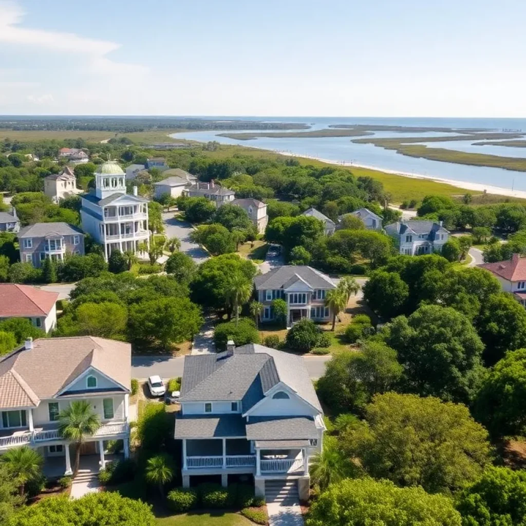
News Summary The Hilton Head Island Metro Area is facing significant fluctuations in home values, with economic pressures impacting affordability. While the typical home value in the U.S. remains stable,...
News Summary Two deputies from the Greenville County Sheriff’s Office were injured during a SWAT training exercise when live rounds were reportedly used. One deputy was shot in the shoulder...
News Summary An investigation into a house fire on Hilton Head Island that claimed the lives of Katherine Condie and her dog Hudson remains inconclusive. The fire, which occurred in...
News Summary Two deputies from the Greenville County Sheriff’s Office were injured during a training exercise involving gunfire. The incident occurred at a vacant building, resulting in one deputy undergoing...

News Summary Hilton Head Island police are urgently searching for 15-year-old Magali Ortiz-Ruiz, who was reported missing after last being seen on Saturday morning. Authorities are concerned for her safety,...

News Summary Andrea Mizell, a South Carolina dance teacher, has been arrested on multiple charges including assault and contributing to the delinquency of minors. The arrest followed allegations from parents...

News Summary A stabbing at a Walmart in Traverse City, Michigan, left at least 11 people injured, prompting an emergency response. The suspect, Bradford James Gille, acted alone and targeted...

News Summary A tragic stabbing incident at a Walmart in Traverse City has resulted in 11 injuries, with six individuals in critical condition. The attack occurred near the checkout area,...

News Summary A hit-and-run incident in Anderson County has led to the death of 65-year-old pedestrian Billy Edward Stamey. The South Carolina Highway Patrol is investigating the crash that occurred...

News Summary Authorities in South Carolina recently seized approximately 156 pounds of fentanyl, marking the largest seizure in the state’s history. The operation, which also recovered 44 pounds of methamphetamine,...

News Summary Paul Dans, a former Trump administration official and Project 2025 architect, announces his candidacy against incumbent Senator Lindsey Graham in South Carolina’s upcoming Republican primary. Dans aims to...
News Summary Andrea Mizell, a South Carolina dance teacher, has been arrested on multiple charges including assault and contributing to the delinquency of minors. The arrest followed allegations from parents...

News Summary U.S. Representative Ralph Norman from South Carolina officially announces his candidacy for governor in 2026. His campaign launch is set for Sunday in Rock Hill. Known for his...

News Summary Representative Ralph Norman has declared his candidacy for the governor’s race in South Carolina, joining a crowded Republican primary. Known for his conservative stance, Norman plans to focus...

News Summary A House subcommittee in South Carolina has voted to subpoena the Department of Justice for records related to the Jeffrey Epstein sex trafficking investigation. The 8-2 vote saw...

News Summary U.S. Senator Lindsey Graham has condemned recent violence against Christians in Taybeh, West Bank, criticizing extremist actions that threaten religious sites. He plans to address Israeli Prime Minister...

News Summary A chaotic shooting during a Juneteenth celebration in Anderson County has left one dead and ten injured. The violence erupted after a fight in a parking lot, resulting...

News Summary A man has been arrested for attempted murder following a hit-and-run at a playground in Sullivan’s Island that injured two children and a teacher. The incident occurred during...

News Summary Alan Wilson, the four-term Republican attorney general of South Carolina, is set to officially enter the race for the state’s open gubernatorial seat. He will launch his campaign...
News Summary South Carolina forward Ashlyn Watkins plans to take the entire upcoming basketball season off due to recovery from an ACL injury. The announcement allows the coaching staff to...
News Summary The South Carolina women’s basketball team has made significant changes to its roster as players prepare for the upcoming season. Key player Ashlyn Watkins will sit out the...
News Summary The Hilton Head Island football team is setting its sights high for the upcoming season after achieving nine wins last year, their highest total in nearly a decade....

News Summary The Cacique Mara team from Venezuela has been denied entry to the Senior League Baseball World Series due to visa complications, causing heartbreak for the young athletes. Little...

News Summary Former NCAA star and NBA player Will Avery hosted a youth basketball camp on Hilton Head Island, focusing on skill enhancement and personal development. The camp was designed...

News Summary The Cincinnati Bengals have signed linebacker Demetrius Knight Jr. to a four-year rookie contract, which is notable for its nearly 80% guaranteed amount. Knight, a standout from South...

News Summary The 2025 RBC Heritage has begun on Hilton Head Island, featuring 72 elite PGA TOUR players competing for a total purse of $20 million. Defending champion Scottie Scheffler...

News Summary Landon Duckworth, a four-star quarterback from Alabama, is set to announce his college commitment on July 18. After narrowing his choices to South Carolina and Auburn, Duckworth’s decision...

News Summary Mitchell Huggins, a dedicated umpire, collapsed and died from heat stroke while officiating a softball game in South Carolina. Concerns about extreme heat were voiced before the incident....


