
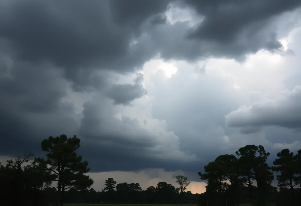
A severe thunderstorm brews in South Carolina, bringing strong winds and rain.
Article Sponsored by:
Mays Contracting is more than just a roofing company; it’s a family legacy built on trust and quality. Founded in 1979, we’ve been serving the community for over four decades. Our story began with a simple vision: to provide exceptional roofing services for both residential and commercial properties. This vision has guided us ever since, as we’ve grown from a small, family-run operation to a trusted name in the industry.

Columbia, SC, is under a severe thunderstorm warning affecting multiple counties including Newberry, Fairfield, and Lexington. Wind gusts could reach 55 mph, prompting locals to secure belongings and seek shelter. Residents are advised to stay informed as the threat of flooding and power outages rises. Another round of storms is forecasted for Sunday, warning of gusts up to 60 mph.
Columbia, SC, is buzzing with weather activity as the National Weather Service has issued a serious thunderstorm warning for multiple counties, including Newberry, Fairfield, Lexington, and Richland. At 7:07 p.m. on Thursday, locals were advised to stay alert until the storm calms down at 8 p.m. If you’re in these areas, it’s time to buckle up and prepare for some wild weather!
The storm is no small matter, with wind gusts potentially reaching up to 55 mph. Just picture this: a strong thunderstorm was spotted just 7 miles north of Dreher Island State Park, moving at a brisk 15 mph to the north. With such winds, there’s a good chance you might see downed tree limbs and scattered objects flying about. It’s essential to secure anything that can blow away tonight!
Some specific spots feeling the storm’s effects include:
Also on alert? The stretch of Interstate 26 between mile markers 67 and 96. Buckle up if you’re driving tonight!
The NWS is stressing the importance of seeking shelter in a building. The torrential rainfall can lead to localized flooding, which you definitely want to avoid. If you see flooded roadways, consider taking a different route! Remember, it’s not just about the rainfall; the threat of frequent lightning strikes—a statistic that shows about 25 million lightning strikes happen annually in the U.S.—is serious. With lightning able to strike up to 10 miles from a storm, you don’t want to be caught outside.
In the wake of the recent storms, there were over 10,000 power outages in the Midlands region of South Carolina. And now with this new storm integrating into the mix, more outages could be on the way. Residents are advised to stock up on supplies and ensure devices are charged in case the power goes out.
As if that’s not enough, South Carolina is in for another round of thunderstorms on Sunday. A severe thunderstorm warning will blanket Columbia, Lexington, and West Columbia starting around 10:40 a.m. and lasting through about 11:15 a.m. Expect wind gusts of up to 60 mph and even hail! The most dangerous time for storms on Sunday looks to be from 10 a.m. to 4 p.m.
Columbia will not see relief anytime soon. The forecast predicts more weather activity through the week, with chances of rain and thunderstorms hanging around. The temperatures might hit nearly 90 degrees, but the humidity will keep residents thinking about umbrellas rather than beach towels!
As South Carolina continues to deal with the weather, take precautions, stay informed, and let’s weather the storm together. Stay safe, everyone!
Berkeley and Dorchester Counties Prepare for Severe Winter Weather
Austin Jared Radel Arrested on Hilton Head Island
Thunderstorm Warning Issued for Barnwell County
Severe Thunderstorm Warnings Blank Charleston Area
Severe Thunderstorm Warning Issued for Orangeburg County
Beaufort County Sheriff’s Office Seeks Austin Jared Radel
Intensified Search for Wanted Individual in Hilton Head Island
Severe Thunderstorms Expected in Abbeville and Greenwood
Aiken County Faces Severe Thunderstorm Warnings – Stay Safe!
Severe Thunderstorm Warning Issued for Greenville-Spartanburg Area
Quality Roof Construction and Repair in Lexington, Richland, Newberry and Laurens Counties for over 40 Years.
News Summary Alan Wilson, South Carolina's four-term Republican attorney general, is set to announce his…
News Summary Michael Haldeman, owner of SpokeWorks Bicycle Workshop, has received the prestigious title of…
News Summary As Small Business Saturday approaches, attention is drawn to the critical role of…
News Summary Eaton Corporation has announced plans to invest $340 million in a new manufacturing…
News Summary Duke Energy has proposed a 12.1% electricity rate increase in South Carolina to…
News Summary The Spartanburg Day varsity tennis team has secured its second consecutive SCISA championship…