Beaufort County, South Carolina, August 1, 2025 News Summary Beaufort County, South Carolina, is set to implement a new flood alert system designed to better inform residents about flooding conditions starting...

Charlotte, NC, August 1, 2025 News Summary The 2025 Hyundai Palisade Calligraphy Night Edition is set to redefine family SUVs with its luxurious features, including a massage seat for enhanced comfort....
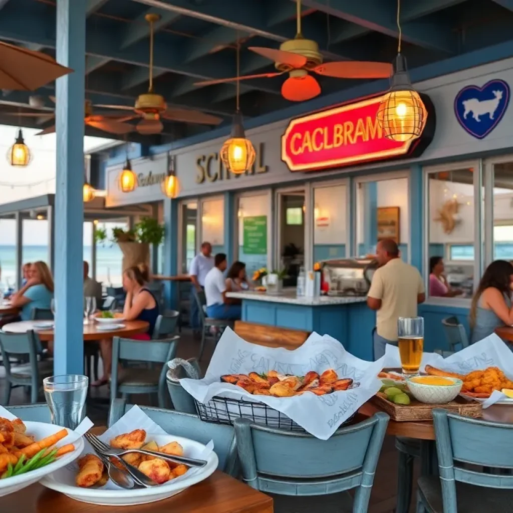
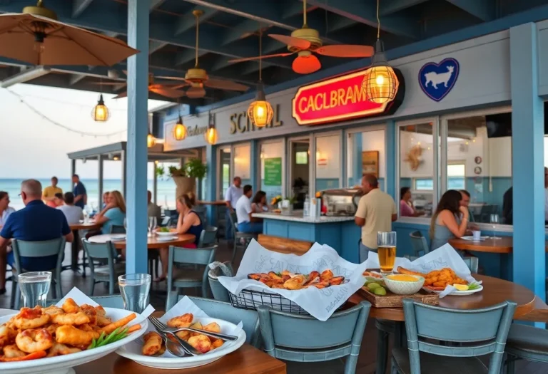
Myrtle Beach, August 1, 2025 News Summary Yelp’s recent ranking showcases South Carolina’s culinary scene, emphasizing the popularity of coastal restaurants. With 77 of the top 100 eateries located by the...

News Summary The South Carolina Gamecocks are gearing up for their fifth preseason under head coach Shane Beamer, following a successful nine-win season. The team has convened to discuss goals...

News Summary Officials in South Carolina confirmed a radioactive wasp nest was found at the Savannah River Site, revealing radiation levels exceeding federal limits. The nest, located near nuclear waste...

News Summary Residents of Walhalla, South Carolina, are under a boil water advisory due to a significant water leak that has resulted in reduced water pressure across the city. The...

News Summary Severe thunderstorms are impacting multiple counties in South Carolina, particularly Sumter and Clarendon. The National Weather Service warns of strong winds and hazardous conditions, with gusts up to...
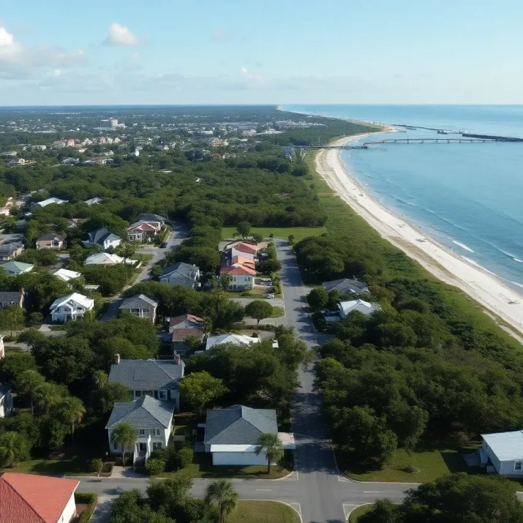
News Summary Hilton Head Island is grappling with a significant shortage of affordable workforce housing due to rising living costs and increased commuter numbers. As rents soar, essential workers are...

News Summary South Carolina currently has no state agency performing regular inspections of hotels and motels, raising concerns over cleanliness, sanitation, and safety for travelers. Although some local regulations exist,...

Best ERP for Commercial Construction Firms in Hilton Head, SC: Uprite Construction Introduction Hilton Head, South Carolina, is a hub for commercial construction, driven by its thriving tourism industry, resort...

News Summary Surchero’s Fresh-Mex is opening its fourth location in South Carolina at 2221 Boiling Springs Road on August 12. The grand opening features free burritos for the first 100...

News Summary The Cannons Campground Road Bridge in Spartanburg County has been closed since May due to severe damage. Local businesses report significant income losses, with customer traffic dropping by...

News Summary The Spartanburg County Foundation has awarded a $150,000 grant to Palmetto InnovaSphere to enhance talent recruitment in the life sciences sector. Over three years, this funding will support...
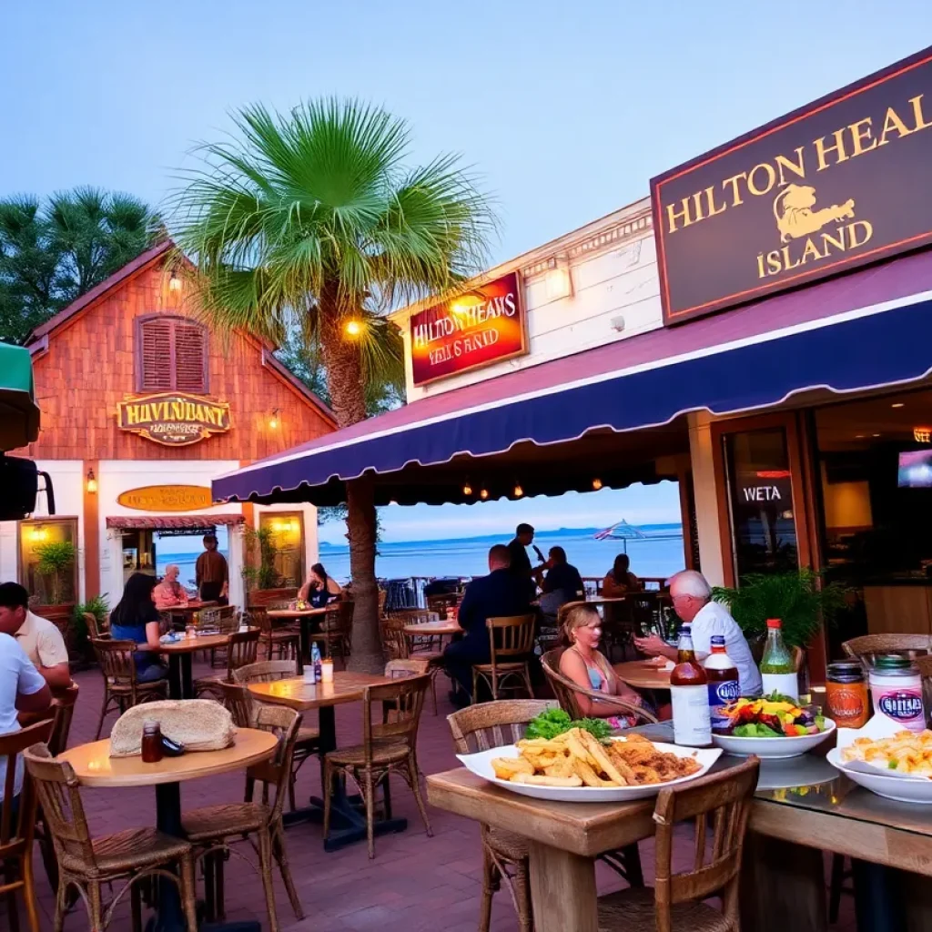
News Summary Hilton Head Island, South Carolina, is experiencing a culinary renaissance as summer attracts a significant surge in visitors. The island’s innovative food scene reflects Lowcountry traditions, offering a...

News Summary The Medical University of South Carolina (MUSC) has been recognized as the top hospital in South Carolina for 2025 by U.S. News & World Report. This marks the...

News Summary South Carolina will begin allowing lottery retailers to accept debit cards for ticket purchases starting July 1. This change, aimed at modernizing transactions, is expected to generate an...

News Summary The Better Business Bureau warns of a phone scam in Kershaw County, where a 66-year-old woman almost lost $2,500. The scammer posed as a federal prosecutor’s office employee,...

News Summary LRT Company has fully subscribed its $17 million Delaware statutory trust offering, LRT Hardeeville Senior Living DST, aimed at developing a 154-unit assisted living and memory care community...

Savannah, Georgia, August 1, 2025 News Summary Renowned country artist Dwight Yoakam is scheduled to perform at Enmarket Arena in Savannah, Georgia on November 14. This concert is part of his...

News Summary The Hilton Head Prep Dolphins are determined to improve their performance this football season following a challenging last season. Under the leadership of Head Coach Doug McFadden, the...
News Summary Hilton Head Island, South Carolina, is experiencing a culinary renaissance as summer attracts a significant surge in visitors. The island’s innovative food scene reflects Lowcountry traditions, offering a...
News Summary LRT Company has fully subscribed its $17 million Delaware statutory trust offering, LRT Hardeeville Senior Living DST, aimed at developing a 154-unit assisted living and memory care community...
News Summary Hilton Head Island is projected to collect over $12 million in accommodation tax revenue for the upcoming fiscal year, reflecting its dependency on tourism. Local leaders are currently...

News Summary Hilton Head Island has begun the renovation of South Beach Marina Village with a partial demolition of its historic buildings. This project aims to modernize the complex while...

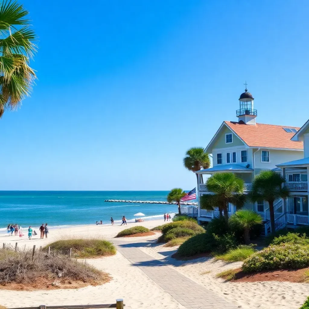
News Summary Hilton Head Island is quickly becoming a popular summer destination for families from Charlotte, offering gorgeous beaches, abundant wildlife, and a wealth of family activities within a short...
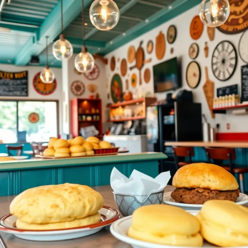
News Summary Hilton Head Island’s Bad Biscuit has been named one of the top 12 biscuit restaurants in the South by Southern Living magazine. Known for its adventurous biscuits and...

News Summary The Hilton Head Island football team is setting its sights high for the upcoming season after achieving nine wins last year, their highest total in nearly a decade....

News Summary Two deputies from the Greenville County Sheriff’s Office were injured during a SWAT training exercise when live rounds were reportedly used. One deputy was shot in the shoulder...

News Summary An investigation into a house fire on Hilton Head Island that claimed the lives of Katherine Condie and her dog Hudson remains inconclusive. The fire, which occurred in...

News Summary Two deputies from the Greenville County Sheriff’s Office were injured during a training exercise involving gunfire. The incident occurred at a vacant building, resulting in one deputy undergoing...

News Summary Hilton Head Island police are urgently searching for 15-year-old Magali Ortiz-Ruiz, who was reported missing after last being seen on Saturday morning. Authorities are concerned for her safety,...

News Summary Andrea Mizell, a South Carolina dance teacher, has been arrested on multiple charges including assault and contributing to the delinquency of minors. The arrest followed allegations from parents...

News Summary A stabbing at a Walmart in Traverse City, Michigan, left at least 11 people injured, prompting an emergency response. The suspect, Bradford James Gille, acted alone and targeted...

News Summary A tragic stabbing incident at a Walmart in Traverse City has resulted in 11 injuries, with six individuals in critical condition. The attack occurred near the checkout area,...

News Summary A hit-and-run incident in Anderson County has led to the death of 65-year-old pedestrian Billy Edward Stamey. The South Carolina Highway Patrol is investigating the crash that occurred...

News Summary Authorities in South Carolina recently seized approximately 156 pounds of fentanyl, marking the largest seizure in the state’s history. The operation, which also recovered 44 pounds of methamphetamine,...

News Summary Paul Dans, a former Trump administration official and Project 2025 architect, announces his candidacy against incumbent Senator Lindsey Graham in South Carolina’s upcoming Republican primary. Dans aims to...
News Summary Andrea Mizell, a South Carolina dance teacher, has been arrested on multiple charges including assault and contributing to the delinquency of minors. The arrest followed allegations from parents...

News Summary U.S. Representative Ralph Norman from South Carolina officially announces his candidacy for governor in 2026. His campaign launch is set for Sunday in Rock Hill. Known for his...

News Summary Representative Ralph Norman has declared his candidacy for the governor’s race in South Carolina, joining a crowded Republican primary. Known for his conservative stance, Norman plans to focus...

News Summary A House subcommittee in South Carolina has voted to subpoena the Department of Justice for records related to the Jeffrey Epstein sex trafficking investigation. The 8-2 vote saw...

News Summary U.S. Senator Lindsey Graham has condemned recent violence against Christians in Taybeh, West Bank, criticizing extremist actions that threaten religious sites. He plans to address Israeli Prime Minister...

News Summary A chaotic shooting during a Juneteenth celebration in Anderson County has left one dead and ten injured. The violence erupted after a fight in a parking lot, resulting...

News Summary A man has been arrested for attempted murder following a hit-and-run at a playground in Sullivan’s Island that injured two children and a teacher. The incident occurred during...

News Summary Alan Wilson, the four-term Republican attorney general of South Carolina, is set to officially enter the race for the state’s open gubernatorial seat. He will launch his campaign...
News Summary The South Carolina Gamecocks are gearing up for their fifth preseason under head coach Shane Beamer, following a successful nine-win season. The team has convened to discuss goals...
News Summary The Hilton Head Prep Dolphins are determined to improve their performance this football season following a challenging last season. Under the leadership of Head Coach Doug McFadden, the...

News Summary South Carolina forward Ashlyn Watkins plans to take the entire upcoming basketball season off due to recovery from an ACL injury. The announcement allows the coaching staff to...

News Summary The South Carolina women’s basketball team has made significant changes to its roster as players prepare for the upcoming season. Key player Ashlyn Watkins will sit out the...
News Summary The Hilton Head Island football team is setting its sights high for the upcoming season after achieving nine wins last year, their highest total in nearly a decade....

News Summary The Cacique Mara team from Venezuela has been denied entry to the Senior League Baseball World Series due to visa complications, causing heartbreak for the young athletes. Little...

News Summary Former NCAA star and NBA player Will Avery hosted a youth basketball camp on Hilton Head Island, focusing on skill enhancement and personal development. The camp was designed...

News Summary The Cincinnati Bengals have signed linebacker Demetrius Knight Jr. to a four-year rookie contract, which is notable for its nearly 80% guaranteed amount. Knight, a standout from South...

News Summary The 2025 RBC Heritage has begun on Hilton Head Island, featuring 72 elite PGA TOUR players competing for a total purse of $20 million. Defending champion Scottie Scheffler...