Charleston, SC, August 11, 2025 News Summary The National Weather Service in Charleston, SC, will modify its flood warning criteria starting August 1, aiming to improve public communication and safety in...

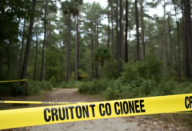
Rembert, South Carolina, August 11, 2025 News Summary The Sumter County Coroner’s Office has confirmed the discovery of two bodies of women in a wooded area in Rembert, South Carolina. Identified...

Hilton Head Island, August 11, 2025 News Summary Hilton Head Island, South Carolina, faced significant power outages impacting about 2,400 customers due to a transformer failure. The outages began shortly after...

Jasper County, Georgia, August 11, 2025 News Summary The National Weather Service has issued a flash flood warning for Jasper County due to anticipated heavy rainfall from a band of thunderstorms....

Charleston, SC, August 10, 2025 News Summary Charleston, South Carolina, is introducing new flood risk communication measures effective August 1, 2025. The National Weather Service (NWS) will revise the classification criteria...

Hilton Head, South Carolina, August 10, 2025 News Summary Hilton Head, South Carolina, boasts 15 restaurants ranked among the top 100 in the state according to Yelp’s August list. Renowned for...

Myrtle Beach, August 10, 2025 News Summary Myrtle Beach experienced a rare 1.9-magnitude earthquake early on a Saturday, with the epicenter located near Bucksport. While residents reported light shaking, there were...

Hilton Head Island, South Carolina, August 9, 2025 News Summary Hilton Head Island is experiencing a decline in Canadian tourism, with a 33% drop in travel compared to the previous year....

Hilton Head Island, SC, August 9, 2025 News Summary A 12-year-old girl was airlifted to Savannah, Georgia, after a shark bite while swimming near Sea Pines in Hilton Head Island. The...

News Summary The Stamford Board of Representatives has unanimously passed an ordinance regulating single-use plastics in restaurants and grocery stores. The guidelines mandate the use of reusable foodware, with some...

News Summary South Carolina Representative Ralph Norman has defended President Trump’s tariffs, asserting that they help the U.S. economy despite escalating consumer prices. Although a recent poll shows disapproval of...

News Summary Fluor Field, home to the Greenville Drive, has significantly contributed to the local economy, generating nearly $300 million over the past decade. Designed by Craig Brown, this stadium...

United States, August 11, 2025 News Summary Home prices in the U.S. have reached astonishing levels, leading to a surge in million-dollar homes. This shift indicates a changing landscape where such...

News Summary Anne Wilson will host a benefit concert at Corbin Arena to raise funds for families affected by the recent tornado in Eastern Kentucky. Proceeds will support local recovery...

News Summary The John Ball Zoo in Kent County is planning to construct a large-scale aquarium estimated to cost between $370 million and $390 million. The project aims for completion...

News Summary In July, South Carolina reached a historic milestone with its State Housing Finance and Development Authority providing assistance to 276 homebuyers, totaling nearly $70 million. This success marks...

Hilton Head, August 10, 2025 News Summary Hilton Head has approved the design for a new Aldi grocery store to be located at 80 Matthews Drive within Sea Turtle Marketplace. The...
Hilton Head Island, August 9, 2025 News Summary Hilton Head Island is contemplating new regulations to manage short-term rentals as tourism surges. Issues such as noise, parking congestion, and community safety...
United States, August 11, 2025 News Summary Home prices in the U.S. have reached astonishing levels, leading to a surge in million-dollar homes. This shift indicates a changing landscape where such...
Hilton Head, August 10, 2025 News Summary Hilton Head has approved the design for a new Aldi grocery store to be located at 80 Matthews Drive within Sea Turtle Marketplace. The...

Hilton Head Island, SC, August 9, 2025 News Summary The Lowcountry Golf Hall of Fame held its ninth induction ceremony recently on Hilton Head Island, honoring Rosie Jones, Jack Nicklaus, and...
Hilton Head Island, August 9, 2025 News Summary Hilton Head Island is contemplating new regulations to manage short-term rentals as tourism surges. Issues such as noise, parking congestion, and community safety...

Hardeeville, SC, August 9, 2025 News Summary LRT Company has concluded its $17 million Delaware Statutory Trust offering to fund a new senior living community in Hardeeville, SC. The project will...

Hilton Head Island, August 9, 2025 News Summary As summer fades, Hilton Head Island shines with an exciting array of drinks that captivated visitors and locals alike. This season’s highlights include...

Hilton Head Island, August 9, 2025 News Summary Gasoline prices on Hilton Head Island have risen to $2.92 per gallon, marking a 3.0% increase over the past week due to conflicts...

Hilton Head Island, August 9, 2025 News Summary Hilton Head Hospital celebrated its 50th anniversary, recognizing its role in addressing the healthcare needs of Hilton Head Island. Since its establishment in...

Hilton Head Island, August 8, 2025 News Summary As summer comes to a close, Hilton Head Island locals reminisce about the season’s standout drinks and eateries. From frozen Mudslides at Jamaica...
Rembert, South Carolina, August 11, 2025 News Summary The Sumter County Coroner’s Office has confirmed the discovery of two bodies of women in a wooded area in Rembert, South Carolina. Identified...

News Summary The Columbia Police Department is ramping up efforts to find 31-year-old Christina Islam, who was reported missing after not returning from an errand on July 30. Friends and...

News Summary The Dorchester County Sheriff’s Office has launched an investigation into a body discovered in Harleyville. Reported on August 3, authorities responded to a suspicious package leading to the...

News Summary A late-night shooting in south Charlotte has led to the death of a man, identified as Stephen Jerome Carroll II. Authorities arrested Steven Downing Jr., charging him with...

Hardeeville, SC, August 2, 2025 News Summary Nayquan Unique Gadson, a 22-year-old from Hardeeville, has received a life sentence for the murder of Breiner Daniel Puerto-Gonzalez, a 19-year-old hotel worker. The...

News Summary Two deputies from the Greenville County Sheriff’s Office were injured during a SWAT training exercise when live rounds were reportedly used. One deputy was shot in the shoulder...

News Summary An investigation into a house fire on Hilton Head Island that claimed the lives of Katherine Condie and her dog Hudson remains inconclusive. The fire, which occurred in...

News Summary Two deputies from the Greenville County Sheriff’s Office were injured during a training exercise involving gunfire. The incident occurred at a vacant building, resulting in one deputy undergoing...

News Summary Hilton Head Island police are urgently searching for 15-year-old Magali Ortiz-Ruiz, who was reported missing after last being seen on Saturday morning. Authorities are concerned for her safety,...
Hilton Head Island, South Carolina, August 9, 2025 News Summary Hilton Head Island is experiencing a decline in Canadian tourism, with a 33% drop in travel compared to the previous year....
Hilton Head, August 6, 2025 News Summary Residents of the Holiday Homes neighborhood in Hilton Head are fighting back against a developer’s proposal for three new three-story houses intended for short-term...

News Summary Over 50 Democratic lawmakers in Texas have fled the state to prevent a GOP redistricting plan aimed at increasing Republican congressional seats. The maneuver seeks to deny Republicans...

News Summary Rep. Nancy Mace has officially announced her candidacy for governor of South Carolina, aiming to succeed term-limited Gov. Henry McMaster. Mace, a third-term U.S. House representative, emphasized the...

News Summary Paul Dans, a former Trump administration official and Project 2025 architect, announces his candidacy against incumbent Senator Lindsey Graham in South Carolina’s upcoming Republican primary. Dans aims to...

News Summary Andrea Mizell, a South Carolina dance teacher, has been arrested on multiple charges including assault and contributing to the delinquency of minors. The arrest followed allegations from parents...

News Summary U.S. Representative Ralph Norman from South Carolina officially announces his candidacy for governor in 2026. His campaign launch is set for Sunday in Rock Hill. Known for his...

News Summary Representative Ralph Norman has declared his candidacy for the governor’s race in South Carolina, joining a crowded Republican primary. Known for his conservative stance, Norman plans to focus...

News Summary A House subcommittee in South Carolina has voted to subpoena the Department of Justice for records related to the Jeffrey Epstein sex trafficking investigation. The 8-2 vote saw...
Hilton Head Island, SC, August 9, 2025 News Summary The Lowcountry Golf Hall of Fame held its ninth induction ceremony recently on Hilton Head Island, honoring Rosie Jones, Jack Nicklaus, and...

Columbia, South Carolina, August 4, 2025 News Summary Columbia, South Carolina is set for a rainy day with a 70% chance of precipitation. Despite the weather, local sports teams are celebrating...

Hilton Head Island, August 4, 2025 News Summary Hilton Head Christian Academy (HHCA) is focused on reclaiming its status in SCISA AAA football after a semifinal loss last season. With 18...

News Summary The South Carolina Gamecocks are gearing up for their fifth preseason under head coach Shane Beamer, following a successful nine-win season. The team has convened to discuss goals...

News Summary The Hilton Head Prep Dolphins are determined to improve their performance this football season following a challenging last season. Under the leadership of Head Coach Doug McFadden, the...

News Summary South Carolina forward Ashlyn Watkins plans to take the entire upcoming basketball season off due to recovery from an ACL injury. The announcement allows the coaching staff to...

News Summary The South Carolina women’s basketball team has made significant changes to its roster as players prepare for the upcoming season. Key player Ashlyn Watkins will sit out the...

News Summary The Hilton Head Island football team is setting its sights high for the upcoming season after achieving nine wins last year, their highest total in nearly a decade....

News Summary The Cacique Mara team from Venezuela has been denied entry to the Senior League Baseball World Series due to visa complications, causing heartbreak for the young athletes. Little...