News Summary
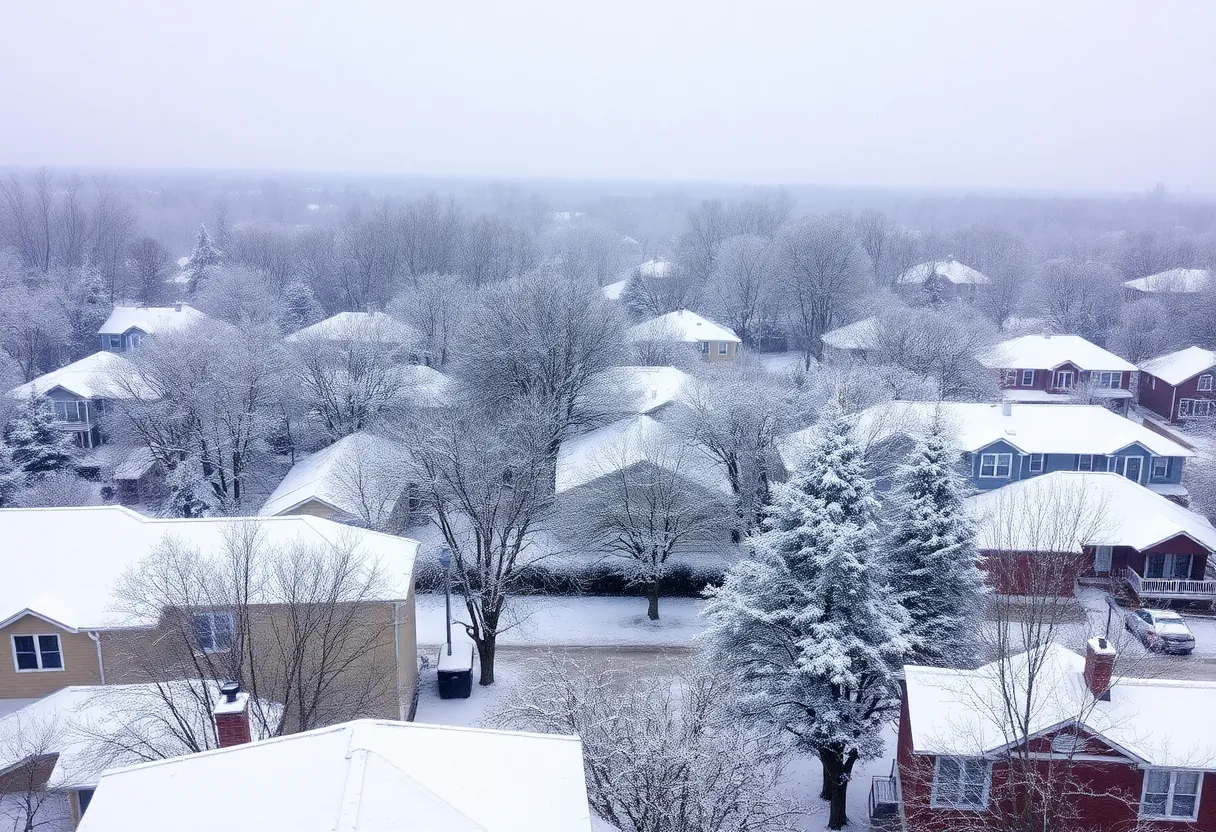
Columbia, SC is bracing for a significant winter storm bringing wintry temperatures and snowfall throughout the week. The National Weather Service predicts cold air and snow accumulation of one to three inches, with impacts particularly severe south of Interstate 20. Motorists are advised to exercise caution due to icy conditions and potential vehicle accidents. Authorities are salting roads in advance, and travelers are encouraged to limit unnecessary travel. The storm marks the third snow event of the season for the Midlands, raising concerns about cold-related hazards and road safety.
Columbia, SC is preparing for a significant winter storm, with forecasts indicating wintry temperatures and snowfall likely throughout the week. According to the National Weather Service (NWS), cold air is expected to settle in starting Sunday night, continuing into the week with high temperatures in the 30s and overnight lows plummeting into the teens. The wind chill factor may dip below 15 degrees at night, particularly during the coldest days from Tuesday through Thursday.
The NWS has increased its confidence that much of South Carolina will experience snowfall, projecting accumulation between one to three inches from Tuesday into Wednesday. This winter storm is labeled as “highly impactful,” with areas south of Interstate 20 expected to face the worst effects. Warnings have also been issued regarding the potential for frozen pipes and hazardous conditions for those without proper shelter.
Motorists are urged to exercise extreme caution when driving in these conditions, as treacherous weather is predicted to create numerous vehicle accidents and reports of stranded drivers. The Midlands, Lowcountry, and Pee Dee regions are expected to be hit hardest by the storm, while the Upstate region may see less snowfall accumulation. In Columbia, a wintry mix of freezing rain, sleet, and snow is possible on Wednesday, contingent upon temperature fluctuations.
Looking ahead, Wednesday night is projected to have a low of 30 degrees, alongside a 30% chance of precipitation. Total precipitation is anticipated to be less than half an inch, with only a tenth of an inch expected from any wintry mix. Amidst these preparations, the South Carolina Department of Transportation has been salting roads in anticipation of the storm, prioritizing primary routes before secondary roads.
Beyond the impending storm, cold weather will persist. From Thursday to Friday, temperatures are forecasted to drop into the 20s, raising concerns about the potential for refreezing and dangerous black ice conditions. However, a gradual warming trend is expected by the weekend, with daytime highs projected to reach the 50s and 60s.
This winter forecast marks the third snowstorm to impact the Midlands in 2025, a region that seldom sees freezing precipitation. Earlier storms this year included significant snowfall events on January 10 and January 22, with Columbia Metropolitan Airport recording accumulations of nearly an inch and some areas receiving up to 4 inches. The last time Columbia experienced snowfall was in January 2022, with up to 3 inches reported then.
In light of the current weather conditions, authorities are advising the public to take precautions against frostbite and hard freezes by dressing warmly when venturing outdoors. Travelers are also advised to avoid unnecessary travel due to the risky conditions on the roads, as some motorists have already encountered difficulties, including getting stuck in snow.
With conditions continuing to evolve, it is recommended that residents keep informed and check for ongoing updates regarding the storm’s impact and any potential changes to forecasts as the situation develops.
Deeper Dive: News & Info About This Topic
- The State
- WYFF 4
- WIS TV
- Encyclopedia Britannica: Winter Weather
- WACH
- Google Search: Winter Storm South Carolina

Author: STAFF HERE HILTON HEAD
The HILTON HEAD STAFF WRITER represents the experienced team at HEREHiltonHead.com, your go-to source for actionable local news and information in Hilton Head Island, Beaufort County, and beyond. Specializing in "news you can use," we cover essential topics like product reviews for personal and business needs, local business directories, politics, real estate trends, neighborhood insights, and state news affecting the area—with deep expertise drawn from years of dedicated reporting and strong community input, including local press releases and business updates. We deliver top reporting on high-value events such as the RBC Heritage golf tournament, Hilton Head Island Wine & Food Festival, and the Gullah Celebration. Our coverage extends to key organizations like the Hilton Head Island-Bluffton Chamber of Commerce and Community Foundation of the Lowcountry, plus leading businesses in tourism and hospitality that power the local economy such as Sea Pines Resort and Sonesta Resort Hilton Head Island. As part of the broader HERE network, including HEREAiken.com, HEREBeaufort.com, HEREChapin.com, HERECharleston.com, HEREClinton.com, HEREColumbia.com, HEREGeorgetown.com, HEREGreenwood.com, HEREGreenville.com, HEREHiltonHead.com, HEREIrmo.com, HEREMyrtleBeach.com, HERENewberry.com, HERERockHill.com, and HERESpartanburg.com, we provide comprehensive, credible insights into South Carolina's dynamic landscape.


