News Summary
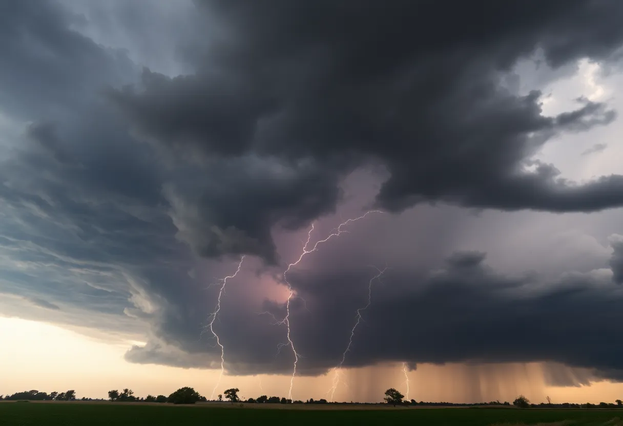
A severe thunderstorm warning has been issued for Barnwell County, effective until 6:45 p.m. Wind gusts up to 55 mph are expected, posing risks to residents. The storm, moving southeast at 20 mph, may lead to localized flooding and is affecting areas including Waynesboro, Hephzibah, and more. People are urged to find shelter and drive cautiously due to hydroplaning risks. This warning comes on the heels of recent tornadoes in the region, highlighting the unpredictability of the weather.
Severe Thunderstorm Warning Hits Barnwell County: Stay Alert!
If you’re in Barnwell County tonight, you may want to pay extra attention. The National Weather Service has issued a strong thunderstorm warning that’s got everyone talking. As of 6:02 p.m., this warning is set to remain in effect until 6:45 p.m., and the folks in charge are taking it very seriously.
Brace for Impact with Gusty Winds
According to the latest reports, wind gusts could reach speeds of up to 55 mph. That’s not just a gentle breeze; we’re talking about winds strong enough to potentially knock over tree limbs and toss unsecured items around. So, if you haven’t secured your patio furniture just yet, now might be a good time!
Where’s the Storm?
At 6:01 p.m., radar was tracking these mighty thunderstorms stretching from near Wrens all the way to Sardis, moving southeast at a speed of about 20 mph. The storm could bring torrential rain, which means localized flooding could be a concern—you don’t want to drive through flooded roadways!
Locations Under Threat
So, who should be on high alert? Residents in places like Waynesboro, Plant Vogtle, Hephzibah, Sardis, Midville, and more should prepare for possible storm impact. Even the Burke County Airport and areas around Di-Lane Wildlife Management Area are included in the advisory.
Safety First!
For anyone who’s outdoors during these storms, the best advice is to find shelter indoors, away from windows. The storms not only bring heavy rain and strong winds but also the risk of lightning. Did you know that roughly 25 million lightning strikes hit the U.S. every year? Most of these strikes occur during the summer months, with around 20 fatalities each year as a direct result of such storms. So, don’t underestimate the danger!
Hydroplaning Risks and Previous Tornado Activity
Another concern with heavy rain is the risk of hydroplaning, which occurs when water builds up in front of your tires faster than your vehicle can push it away, leading to loss of control. Please drive cautiously!
In addition to the storm warnings today, the past week has already shown how unpredictable weather can be. On earlier occasions, at least three tornadoes were confirmed in the Central Savannah River Area (CSRA). Burke County faced two EF-0 tornadoes with winds picking up to 80 mph, while Barnwell County reported one EF-0 tornado. Each tornado covered some ground—4.35 miles for one and just 0.3 miles for the one in Barnwell.
A Cautionary Tale from the Weekend
Even more astonishing, an EF-1 tornado touched down in Chapin, SC, this past Sunday, creating a whirlwind of trouble over a 5.8-mile stretch. This tornado was 125 yards wide and caused damage to properties, but remarkably, no serious injuries were reported during the storms throughout South Carolina.
As the night falls and storms rumble through Barnwell County, it’s crucial for everyone to stay alert, stay informed, and—above all—stay safe! Keep an eye on the weather and be sure to follow any updates for your area. We hope for a calm evening soon!
Deeper Dive: News & Info About This Topic
HERE Resources
Severe Thunderstorm Warning Hits South Carolina and Georgia
Severe Thunderstorms Lead to Widespread Power Outages in Lowcountry
Historic $12.5 Million Sale Sets New Record on Hilton Head Island
Rising Home Prices Create Challenges in Hilton Head Island
Severe Thunderstorm Alerts Issued for Edgefield and Aiken Counties
Tropical Storm Debby Causes Devastation Across Southeastern U.S.
Camp Leo Celebrates 50th Anniversary on Hilton Head Island
Severe Thunderstorm Alerts Issued for Charleston Area
Heat Advisory Issued for Multiple Counties in SC and GA
Severe Thunderstorms Impact South Carolina Regions
Additional Resources
- Island Packet
- Wikipedia: Severe Thunderstorm Warning
- Island Packet
- Google Search: Severe Thunderstorm Warning
- Herald Online
- Google Scholar: Storm Meteorology
- WRDW
- Encyclopedia Britannica: Tornado
- Spectrum Local News
- Google News: South Carolina Weather
Author: STAFF HERE HILTON HEAD
The HILTON HEAD STAFF WRITER represents the experienced team at HEREHiltonHead.com, your go-to source for actionable local news and information in Hilton Head Island, Beaufort County, and beyond. Specializing in "news you can use," we cover essential topics like product reviews for personal and business needs, local business directories, politics, real estate trends, neighborhood insights, and state news affecting the area—with deep expertise drawn from years of dedicated reporting and strong community input, including local press releases and business updates. We deliver top reporting on high-value events such as the RBC Heritage golf tournament, Hilton Head Island Wine & Food Festival, and the Gullah Celebration. Our coverage extends to key organizations like the Hilton Head Island-Bluffton Chamber of Commerce and Community Foundation of the Lowcountry, plus leading businesses in tourism and hospitality that power the local economy such as Sea Pines Resort and Sonesta Resort Hilton Head Island. As part of the broader HERE network, including HEREAiken.com, HEREBeaufort.com, HEREChapin.com, HERECharleston.com, HEREClinton.com, HEREColumbia.com, HEREGeorgetown.com, HEREGreenwood.com, HEREGreenville.com, HEREHiltonHead.com, HEREIrmo.com, HEREMyrtleBeach.com, HERENewberry.com, HERERockHill.com, and HERESpartanburg.com, we provide comprehensive, credible insights into South Carolina's dynamic landscape.


