News Summary
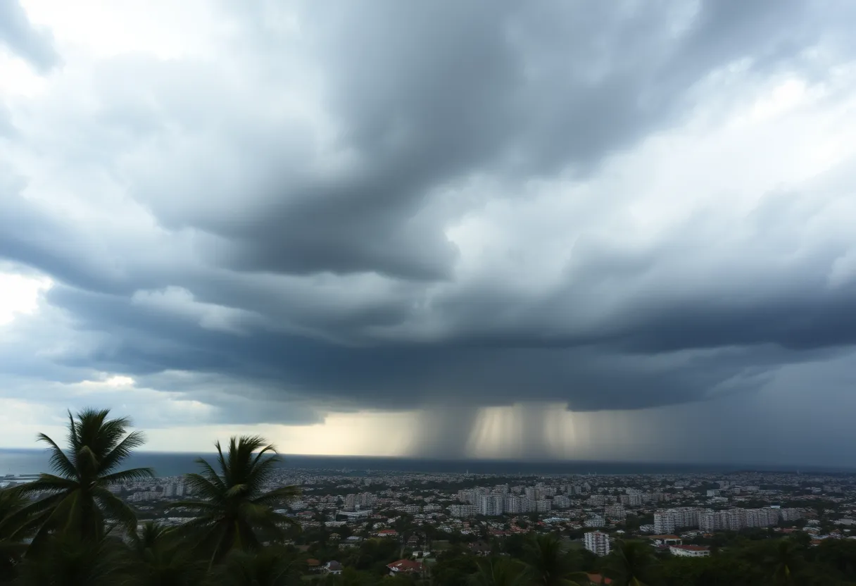
The National Weather Service has issued severe thunderstorm warnings for multiple counties in the Lowcountry of South Carolina, including Jasper and Beaufort. Residents are advised to take safety precautions as storms bring strong winds and the potential for flash flooding. The severe weather conditions require residents to remain indoors during thunderstorms and stay updated through local news outlets. Wind gusts could reach up to 60 mph, and rainfall amounts are projected between 3 to 5 inches. Monitoring updates is crucial as this storm system progresses.
Charleston, SC Issues Severe Thunderstorm Warnings
The National Weather Service (NWS) in Charleston, South Carolina, has issued severe thunderstorm warnings affecting multiple counties in the Lowcountry region, including Inland Jasper, Coastal Jasper, and Beaufort County. The alert, which was announced at 11:45 a.m. on Saturday, will remain in effect until 12:15 p.m.
Doppler radar has detected strong thunderstorms over Rose Hill, which are currently moving to the northeast at a speed of 35 mph. Areas such as Bluffton, Beaufort, Port Royal, Clarendon, Jasper, Lemon Island, Burton, Shell Point, Laurel Bay, and Calawassie Island are included in the warning. Residents along these locations are advised to take precautions as minor damage to outdoor objects is expected, including downed tree limbs and unsecured items being blown around by gusty winds.
Current Safety Recommendations
In light of the severe weather conditions, residents are recommended to stay updated through NOAA Weather Radio All Hazards, television, or local news outlets to receive the latest information regarding the storm. The NWS has issued alerts stressing the importance of seeking shelter indoors during thunderstorms, especially due to the dangers posed by frequent cloud-to-ground lightning strikes. In the United States, lightning strikes approximately 25 million times annually, with a peak frequency in summer, which results in around 20 fatalities each year.
Potential Impacts and Dangers
Motorists should remain vigilant while driving, as hydroplaning may occur when tires lose traction on wet roads due to water buildup. The risk of hydroplaning is amplified by factors such as water depth and tire condition. Additionally, torrential rainfall could lead to flash flooding, with a recommendation against driving through flooded roadways.
Wind gusts are expected to reach up to 60 mph, which could cause damage to roofs, siding, and trees and create dangerous travel conditions, particularly on bridges. The storm system is anticipated to affect transportation routes, including highways I-26 and I-526, throughout specific mile marker ranges.
Extended Thunderstorm Watches
In a separate report released at 8:16 p.m. on Friday, a similar severe thunderstorm warning was issued for Tidal Berkeley and Charleston County until 9 p.m., with wind gusts reported to reach up to 50 mph. Areas impacted by this warning include Hollywood, West Ashley, Johns Island, North Charleston, James Island, Daniel Island, Downtown Charleston, Mount Pleasant, Fort Sumter, and Isle of Palms.
Severe thunderstorm watches remain in effect until 9 p.m. for Charleston County, and until 10 p.m. for Georgetown and Williamsburg Counties. As the storm system progresses, it is expected to reach the I-95 corridor between 3 p.m. and 5 p.m., with conditions hitting the Charleston area between 6 p.m. and 8 p.m.
Storm Prediction Center Alert
The Storm Prediction Center has rated the storm threat for inland South Carolina at a Level 3 out of 5. Rainfall amounts are projected to be heavy, with estimates ranging from 3 to 5 inches expected as the storm front continues to advance across the region. Residents are urged to keep safety in mind during these thunderstorms, prioritizing seeking shelter whenever possible.
Conclusion
As this severe weather front moves through the Lowcountry, prompt action is required to ensure safety. Residents are encouraged to monitor updates closely and adhere to safety recommendations from local officials to protect themselves and their property.
Deeper Dive: News & Info About This Topic
HERE Resources
Severe Thunderstorm and Tornado Watch Issued for Savannah
Severe Thunderstorm Warnings Issued for Lowcountry
Severe Thunderstorm Warnings Hit Charleston and Nearby Counties
South Carolina Residents Urged to Prepare for Hurricane Season
Beaufort’s 175-Year-Old Live Oak Stands Strong Amid City Growth
Severe Thunderstorm Warning Hits Lowcountry
Beaufort County to Launch 2025 Pavement Rejuvenation Program
Severe Thunderstorm and Tornado Warnings Impact South Carolina and Atlanta
Powerful Thunderstorms Shake Chester County
Snow Flurries Hit Upstate South Carolina Amid Warnings
Additional Resources
- Herald Online: Severe Thunderstorm Warning
- Wikipedia: Severe Thunderstorm
- WYFF4: Severe Storm Threat in Greenville
- Google Search: Thunderstorm Safety Tips
- Live 5 News: Severe Thunderstorm Warnings in Lowcountry
- Encyclopedia Britannica: Thunderstorm
- Post and Courier: Severe Thunderstorms in South Carolina
- Google News: South Carolina Weather
- The State: Weather Updates

Author: STAFF HERE HILTON HEAD
The HILTON HEAD STAFF WRITER represents the experienced team at HEREHiltonHead.com, your go-to source for actionable local news and information in Hilton Head Island, Beaufort County, and beyond. Specializing in "news you can use," we cover essential topics like product reviews for personal and business needs, local business directories, politics, real estate trends, neighborhood insights, and state news affecting the area—with deep expertise drawn from years of dedicated reporting and strong community input, including local press releases and business updates. We deliver top reporting on high-value events such as the RBC Heritage golf tournament, Hilton Head Island Wine & Food Festival, and the Gullah Celebration. Our coverage extends to key organizations like the Hilton Head Island-Bluffton Chamber of Commerce and Community Foundation of the Lowcountry, plus leading businesses in tourism and hospitality that power the local economy such as Sea Pines Resort and Sonesta Resort Hilton Head Island. As part of the broader HERE network, including HEREAiken.com, HEREBeaufort.com, HEREChapin.com, HERECharleston.com, HEREClinton.com, HEREColumbia.com, HEREGeorgetown.com, HEREGreenwood.com, HEREGreenville.com, HEREHiltonHead.com, HEREIrmo.com, HEREMyrtleBeach.com, HERENewberry.com, HERERockHill.com, and HERESpartanburg.com, we provide comprehensive, credible insights into South Carolina's dynamic landscape.


